
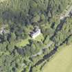
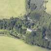
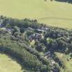
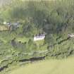
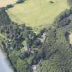
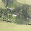
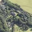
Branxholme, Tentyfoot Tower


Tower (Period Unassigned)
Site Name Branxholme, Tentyfoot Tower
Classification Tower (Period Unassigned)
Alternative Name(s) Branxholme Castle
Canmore ID 231186
Site Number NT41SE 13.01
NGR NT 46439 11687
Datum OSGB36 - NGR
Permalink http://canmore.org.uk/site/231186


- Council Scottish Borders, The
- Parish Hawick
- Former Region Borders
- Former District Roxburgh
- Former County Roxburghshire
This tower is part of the outer defences of Branxholme Castle. (Historic Environment Scotland List Entry). A strengthening tower of the enceinte or walled castle courtyard (now incomplete) (Strang, Borders and Berwick, 1994 p.150)
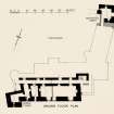
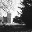
Photographic Survey (1956)
Photographic survey by the Scottish National Buildings Record in 1956.

