
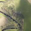
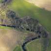
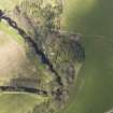
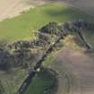
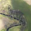
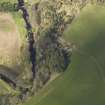
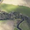
Allanbank, Blackadder Bridge


Bridge (Period Unassigned)
Site Name Allanbank, Blackadder Bridge
Classification Bridge (Period Unassigned)
Alternative Name(s) Blackadder Water; Blackadder Suspension Bridge
Canmore ID 230804
Site Number NT85SE 47
NGR NT 85568 54249
Datum OSGB36 - NGR
Permalink http://canmore.org.uk/site/230804


- Council Scottish Borders, The
- Parish Edrom
- Former Region Borders
- Former District Berwickshire
- Former County Berwickshire
NT85SE 47 85568 54249
This bridge carries a track or path over the Blackadder water to the S of Allanbank steading (NT85SE 31.01).
Information from RCAHMS (RJCM), 3 February 2006.

