Pricing Change
New pricing for orders of material from this site will come into place shortly. Charges for supply of digital images, digitisation on demand, prints and licensing will be altered.
Glen Sherrup
Field System (Medieval) - (Post Medieval), Hut (Post Medieval), Lade (Post Medieval), Rig And Furrow (Medieval) - (Post Medieval), Track (Post Medieval)
Site Name Glen Sherrup
Classification Field System (Medieval) - (Post Medieval), Hut (Post Medieval), Lade (Post Medieval), Rig And Furrow (Medieval) - (Post Medieval), Track (Post Medieval)
Canmore ID 229680
Site Number NN90SE 68
NGR NN 9644 0486
NGR Description centred on NN 9644 0486
Datum OSGB36 - NGR
Permalink http://canmore.org.uk/site/229680
- Council Perth And Kinross
- Parish Glendevon
- Former Region Tayside
- Former District Perth And Kinross
- Former County Perthshire
Field Visit (21 May 1998)
NN90NE 68 centred on 9644 0486
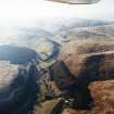
Wester Glensherup farmsteading is situated on the E end of a flat-topped spur bounded by the River Devon to the N and the Glensherup Burn on the S. On this spur, and extending along the hillside on the W side of Glen Sherup, there is an extensive field-system that predates a drystone wall that cuts across the W end of the spur and is depicted on the 1st edition of the OS 6-inch map (Perthshire and Clackmannanshire 1866, sheet cxvii). In addition to this drystone wall and another cutting across the spur to the N of the farmsteading, the 1st edition map shows a series of large enclosures extending along the glen, taking in both improved and rough ground; nothing is now visible of the enclosures, which must have been enclosed by fences.
The earlier field-system is defined by earth and stone banks which are, in many cases, now ploughed down and only visible on aerial photographs (106G/SCOT UK 120, frame nos. 4264 and 4265, 20 June 1946). The subrectangular fields measure up to 140m across. The field-system also extends across the spur to the W of Wester Glensherup and along the lower slopes of The Shank. To the S a discrete field (NN 9618 0433) overlies traces of an earlier field-bank. A small subrectangular turf-walled hut, measuring 2.2m from ESE to WSW by 1.2m internally (GDEV98 180, NN 9623 0433), is butted onto the bank along the SE side of this field. It has an entrance in the WNW end.
Many of the field-bank junctions show evidence of sequences of construction and modification, but no overall pattern can be detected. The fields within the banks have been cultivated; some have smooth surfaces, others are scored by shallow furrows, and in many cases there are well-developed lynchets along the upslope and downslope sides. Most of the rig defined by the grooves is straight and narrow, measuring from 3m to 4m in breadth, and can be seen to best effect on aerial photographs (106G/SCOT UK 120, frame nos. 4264, 4265, 20 June 1946 e.g. NN 9636 0516). One block of rig at the S end of the field-system has sinuous furrows set about 6m apart (NN 9637 0458).
A narrow lade leads from the Glensherup Burn to the W side of Wester Glensherup farmyard (from NN 9644 0466 to NN 9666 0506). Comprising a shallow trench with an upcast mound along its lower side, it leaves the burn immediately upstream of a small dam. The lade is depicted on both the 1st edition and 2nd editions of the OS 6-inch map (Perthshire and Clackmannanshire 1866, sheet cxvii; Perthshire and Clackmannanshire 1901, sheet cxxvii).
Two trackways run along the E flank of The Shank, leading from the edge of the field-system (NN 9626 0497) onto the saddle between Ben Shee and The Shank, where there is an extensive area of peat cutting and turf stripping. On the E flank of The Shank the trackways cut across a subrectangular enclosure (NN90SE 56). The lower of the trackways (from NN 9624 0495 to NN 9610 0478), which is the earlier, is depicted on the 1st edition of the OS 6-inch map, but not the 2nd edition of the OS map.
(GDEV98 180)
Visited by RCAHMS (DCC) 21 May 1998


