
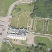
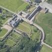
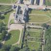
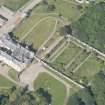
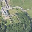
Sandside House, Se Walled Garden


Walled Garden (Period Unassigned)
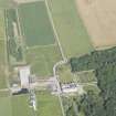
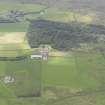
Site Name Sandside House, Se Walled Garden
Classification Walled Garden (Period Unassigned)
Canmore ID 229369
Site Number NC96NE 11.10
NGR NC 95262 65125
NGR Description Centred NC 95262 65125
Datum OSGB36 - NGR
Permalink http://canmore.org.uk/site/229369


- Council Highland
- Parish Reay
- Former Region Highland
- Former District Caithness
- Former County Caithness
NC96NE 11.10 centred 95262 65125

