Pricing Change
New pricing for orders of material from this site will come into place shortly. Charges for supply of digital images, digitisation on demand, prints and licensing will be altered.
Upcoming Maintenance
Please be advised that this website will undergo scheduled maintenance on the following dates:
Thursday, 9 January: 11:00 AM - 3:00 PM
Thursday, 23 January: 11:00 AM - 3:00 PM
Thursday, 30 January: 11:00 AM - 3:00 PM
During these times, some functionality such as image purchasing may be temporarily unavailable. We apologise for any inconvenience this may cause.
Teth Hill
Building(S) (Medieval) - (Post Medieval), Enclosure(S) (Post Medieval), Field System (Medieval) - (Post Medieval), Lade (Post Medieval), Lazy Beds (Post Medieval), Quarry(S) (Post Medieval), Rig And Furrow (Medieval) - (Post Medieval), Track (Medieval) - (Post Medieval)
Site Name Teth Hill
Classification Building(S) (Medieval) - (Post Medieval), Enclosure(S) (Post Medieval), Field System (Medieval) - (Post Medieval), Lade (Post Medieval), Lazy Beds (Post Medieval), Quarry(S) (Post Medieval), Rig And Furrow (Medieval) - (Post Medieval), Track (Medieval) - (Post Medieval)
Alternative Name(s) Back Burn
Canmore ID 229333
Site Number NN90SE 58
NGR NN 9760 0484
Datum OSGB36 - NGR
Permalink http://canmore.org.uk/site/229333
- Council Perth And Kinross
- Parish Glendevon
- Former Region Tayside
- Former District Perth And Kinross
- Former County Perthshire
Field Visit (1 June 1998)
NN90SE 58 9760 0484
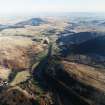
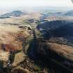
A complex field-system encloses both sides of the valley of the Back Burn and runs across the top of the Teth Hill to the N. A trackway and a lade cross parts of the field-system, and there are also a series of small enclosures, two buildings and two quarries within the enclosed area. The valley has been laid out as an off-road four-wheel drive vehicle course and many of the field-banks have been cut by deeply rutted tracks.
The field-system appears to have expanded across the hillsides progressively, and the conjoined subrectangular and irregular fields show evidence of repeated remodelling. The field-banks on the lower slopes on both sides of the valley have been slighted by later ploughing, the extent of which corresponds with the improved ground shown on the 1st edition of the OS 6-inch map (Perthshire and Clackmannanshire 1866, sheet cxxvii); on the N side of the valley this ground lies below a ruinous drystone wall, also shown on the 1st edition map. At least two subrectangular enclosures, the larger of which measures about 38m by 30m internally, have been built into the angles between field-banks of the field-system (NN 9759 0504, NN 9768 0470). The rig that covers most of the fields is characterised by shallow, slightly curving, furrows set about 5m apart. Some of the rigs have been split and in several patches the furrows pinch together towards one end. The field-system also encloses rough uncultivated ground on the summit of Teth Hill, and on the higher slopes to the S of the Back Burn where the ground is broken by rock outcrop.
The buildings are disposed across a terrace to the S of the Back Burn. Rectangular on plan, with their long axes along the slope from E to W, they measure 5.2m by 2.9m (GDEV98 80, NN 9744 0467) and 7m by 3.1m (GDEV98 81, NN 9755 0464) respectively within turf footings.
The quarries are cut into the E flank of the Teth Hill (NN 9763 0499, NN 9765 0498) within one of the fields of rough ground. Three lazy-beds measuring about 3m across lie to the NNE (NN 9768 0505) and comprise three ridges on the NE flank of Teth Hill, overlying one of the field-banks.
The lade can be seen intermittently on the S side of the valley (from NN 9739 0464 to NN 9767 0478), having been slighted by ploughing for reseeding, probably during the first half of the 20th century; it consistently cuts across the field-banks in its path. A short length of hollow trackway on the S side of the valley (NN 9759 0465) also cuts across two field-banks.
(GDEV98 80, 81)
Visited by RCAHMS (DCC) 1 June 1998
Project (1 May 2016 - 12 May 2017)
Archaeological features were identified and mapped from airborne remote sensing sources, such as lidar, historic vertical aerial photographs, and 25cm orthophotographs.
Information from HES (OA) 12 May 2017


