Accessibility

Font Size

100% 150% 200%

Background Colour

Default Contrast
Close Reset

Inverness, Telford Road, Merkinch Primary School

School (Period Unassigned)

Site Name Inverness, Telford Road, Merkinch Primary School

Classification School (Period Unassigned)

Canmore ID 228646

Site Number NH64NE 687

NGR NH 65860 45902

Datum OSGB36 - NGR

Permalink http://canmore.org.uk/site/228646

Ordnance Survey licence number AC0000807262. All rights reserved.
Canmore Disclaimer. © Bluesky International Limited 2025. Public Sector Viewing Terms

Toggle Aerial | View on large map

Digital Images

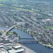
General oblique aerial view of the town, centred on the road bridges and school, taken from the NE.
General oblique aerial view of the town, centred on the road bridges and school, taken from the NE.General view from SEView from ESEView from ESEView from ESEGeneral view from SEAerial view of South Kessock and Merkinch, Inverness, looking NW.General oblique aerial view of the town, centred on the road bridges, school and sawmill, taken from the NE.Near aerial view of Friar's Bridge, Black Bridge and the Railway Viaduct, Inverness, looking SW.General view from SE

Administrative Areas

  • Council Highland
  • Parish Inverness And Bona
  • Former Region Highland
  • Former District Inverness
  • Former County Inverness-shire

Architecture Notes

NH64NE 687 65860 45902

Situated on the W side of Telford Road. Built during 1876, possibly by the architect Alexander Ross.

The school is single storey and H-shaped in plan, bellcote and clock on central front gable. Plaque below the bellcote 'A.D. 1876'.

Merkinch School is first shown on Ordnance Survey maps in 1904, 2nd edition of the OS 25-inch map (Inverness-shire, 1904, sheet c) and all subsequent editions to the 1930's. The building is annotated 'school' in all editions.

Information from RCAHMS (DE), August 2008

References

MyCanmore Image Contributions


Contribute an Image

MyCanmore Text Contributions