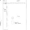
Glasvaar 9
Cup Marked Rock (Prehistoric)
Site Name Glasvaar 9
Classification Cup Marked Rock (Prehistoric)
Canmore ID 22814
Site Number NM80SE 53
NGR NM 88643 01828
Datum OSGB36 - NGR
Permalink http://canmore.org.uk/site/22814
- Council Argyll And Bute
- Parish Kilmichael Glassary
- Former Region Strathclyde
- Former District Argyll And Bute
- Former County Argyll
NM80SE 53 8864 0183
Outcrop at ground level, sloping 5 degrees N, at present exposed to about 5m by 2.75m, on whose smooth surface are 8 cups-and-one-ring, one of which has traces of a possible second ring - up to 15cm diameter; also at least 10 cups. The rings are un-gapped, and all are much weathered. Maximum depth 1cm. The outcrop is 80m SE of NM80SE 6 and NM80SE 30 m E of the road.
R W B Morris 1982.
Field Visit (May 1984)
NM 886018. On a rock-sheet 6.5 m to the E, there are four plain cupmarks (DES 1982, 21).
Visited May 1984
RCAHMS 1988
Note (2 August 2018)
Date Fieldwork Started: 02/08/2018
Compiled by: Parallel Grooves
Location Notes: Glasvaar 9 is located approximately 5 m from Glasvaar 8, and both panels are situated on a raised hillock on the W-facing hillside terrace of Glasvaar farm. Glasvaar 9 sits on the E-facing slope of the hillock, with the surrounding land used for animal grazing. A tumbledown field wall runs SW to NE to the N and W of the panel, following the line of the farm track. There are low turf-covered footings of a probable byre dwelling about 20m to the W, and the remains of other structures to the NW, on the far side of the farm track. The raised outcrop on which the panel is positioned is largely covered by turf. A small copse of three established trees grows to the W of the panel. There are views of the hill slopes and terrace to the SW, but views of the valley are obscured by hillocks on the NW edge of the terrace. Roughly 200m to the S is Glasvaar farm and associated structures, and a burial cairn.
Panel Notes: Glasvaar 9 is a large outcrop measuring 3.8 m by 1 m, with a maximum height of 0.1 m. The panel slopes slightly to the ENE at an incline of 9 degrees. The carved surface is primarily smooth and hard with medium grain, with natural features including coloured bands, fissures/cracks, and natural hollows and weathering channels. Nine single cupmarks are present. Rock type identified using online information from the British Geological Survey. Rock type identified using online information from the British Geological Survey.


