Pricing Change
New pricing for orders of material from this site will come into place shortly. Charges for supply of digital images, digitisation on demand, prints and licensing will be altered.
Kinlochaline Castle
Tower House (Medieval)
Site Name Kinlochaline Castle
Classification Tower House (Medieval)
Alternative Name(s) Ardtornish Estate, Kinlochaline Castle; Kinlochaline Tower House; Aird Toirinis
Canmore ID 22432
Site Number NM64NE 3
NGR NM 69757 47639
Datum OSGB36 - NGR
Permalink http://canmore.org.uk/site/22432
- Council Highland
- Parish Morvern
- Former Region Highland
- Former District Lochaber
- Former County Argyll
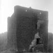
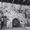
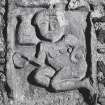
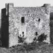
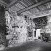
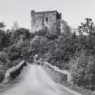
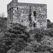
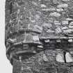
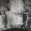
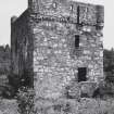
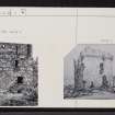
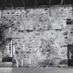
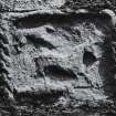
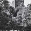
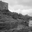
Kinlochaline Castle, probably late 15th century Square-plan tower house of the Macleans of Kinlochaline rising through a canopy of trees above Alexander Ross's Ivy Bridge of 1888. Built over a vaultless cell, the tower was altered c.1600, when two vaulted cellars were introduced and angle turrets and a corbelled parapet gave it a more martial profile. The usual horizontal wing for domestic offices probably extended northwards (now demolished). The first floor entrance, surmounted by a carving of a stag, hound and salmon, leads into the hall. This has a fireplace in the north wall, over which another carved panel depicts a shiela na gig or naked female figure. A mural guardchamber adjoins the entrance, below which a deep pit prison was uncovered in the wall thickness during the recent restoration. Attacked by the 9th Earl of Argyll in 1679, Kinlochaline was roofless by 1730, when it was acquired by Sir Alexander Murray of Stanhope. His restoration plans came to nothing, and repairs were not put in hand until c.1890, when it was remodelled as an eyecatcher by Alexander Ross. For all his antiquarian enthusiasm, Ross was surprisingly unhistoricist in his approach here, enlarging windows and squaring off wallheads. This had a detrimental effect on the castle's romantic appeal, which was captured so dramatically by Horatio McCulloch in 1855. Today, a modern house with crowsteps peeps over the battlements, evidence of the tower's conversion in 1999-2000 to a family home.
Taken from "Western Seaboard: An Illustrated Architectural Guide", by Mary Miers, 2008. Published by the Rutland Press http://www.rias.org.uk
NM64NE 3 69757 47639.
(NM 6975 4763) Kinlochaline Castle (NR)
OS 1:10,000 map, (1975)
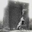
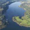
Kinlochaline Castle: This tower-house occupies the N end of a rocky ridge, situated immediately W of the point where the River Aline flows into Loch Aline. The original building, probably of 15th century date, was extensively remodelled in the late 16th or early 17th century. It was involved in the warfare between the MacLeans and Campbells during the last quarter of the 17th century, and has remained unoccupied since that period. By the middle of the 19th century it was in a state of extreme dilapidation, and an unsympathetic restoration of the masonry was undertaken about 1890, when new floors and a metal roof were fitted. The tower contains three storeys, all originally unvaulted, and measures 13.2m from N to S by 10.5m transversely over walls varying in thickness from 2.5m to 2.8m. It is constructed of rubble masonry; most of the freestone dressings, having been robbed, were replaced by rubble in the late 19th century restoration. The internal masonry of the castle, including that of the second period of construction, shows marks of burning.
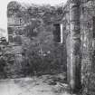
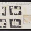
The external appearance of the tower is plain, an effect increased by the excessive size of the window-openings as repaired in the late 19th century. In the original arrangement there were separate entrances to the ground and first floors, both in the S wall; the former was blocked up in the second period, and this blocking was renewed in the restoration. Above the entrance there projects a box-machicolation supported on two massive corbels, probably of 15th century date but in re-use. This feature was completely rebuilt in the 19th century, when extensive restoration was also carried out at parapet-walk level. (Full architectural description and history given by the RCAHMS {1980}).
D MacGibbon and T Ross 1887-92; RCAHMS 1980, visited 1972.
Kinlochaline Castle: as described.
Visited by OS (NKB) 11 June 1970.
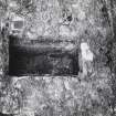
NM 6975 4763 In November 1997 an initial evaluation of the tower house was undertaken prior to its restoration as a dwelling. To assess the survival of any archaeological remains a trench was hand-dug within each of the two cellars in the tower house and also externally in the areas of the proposed septic tank and access road.
Rubble was encountered in both cellar trenches but this may originate from the remodelling of the tower in the 16th and 17th centuries. Midden material was encountered between two layers of rubble suggesting at least two stages of rubble deposition. No archaeological features were discovered in the external trenches.
A complete photographic record of the tower house was also produced and deposited with Highland Council.
Sponsor: Highland Council.
J Harden 1998.
NM 6975 4763 A watching brief was carried out in the castle grounds in Jan-Feb 1998 during work to make a new access road and dig a service trench up to the castle. This was in preparation for the castle being restored by its present owners into a dwelling. The access road leads from the side road between Ardtornish and the A884 to Lochaline. Service lines follow alongside the road, which terminates in a car park.
The route of the new road follows, to a large extent, the route of an old track, disused but still visible as a grassy raised ridge. It runs across a level, wet area, W of the castle. The age of the track is unclear, but its eastern section appears on a local farming plan map of 1833 (Plan of the farms of Kinlochalin and Achaforse, 1833, in Ardtornish Archives) and the whole length is depicted on the OS 1st edition map of 1875 (surveyed 1872). The old track runs straight from the castle NW to the Ardtornish road, while the new road follows this for a stretch, but curves southwards to join the Ardtornish road at a more oblique angle.
A new small car park was created at the SE end of the access road at the foot of the rocky knoll, apon which the castle stands. The old track continued around the N side of the castle. The service lines largely follow the access road on its northern side, but take a more direct route to the Ardtornish road at the NW end.
Little archaeological material was found during the construction work. A small area of burning, 0.2m below the surface, was noted during the construction of the car park. A large number of roofing slates were also uncovered. They are thought to date to the late 16th-early 17th century rebuilding of the castle. Almost all are the locally-derived grey Ballachulish slate, but there is at least one example of green Cumbrian slate.
J G Robertson 1998, MS/1012/2


