
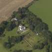
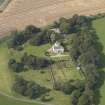
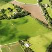
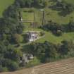
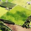
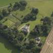
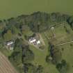
Kinnaber, House Of Kinnaber, Walled Garden


Walled Garden (Period Unassigned)
Site Name Kinnaber, House Of Kinnaber, Walled Garden
Classification Walled Garden (Period Unassigned)
Canmore ID 224252
Site Number NO76SW 84.01
NGR NO 72616 61729
Datum OSGB36 - NGR
Permalink http://canmore.org.uk/site/224252


- Council Angus
- Parish Montrose
- Former Region Tayside
- Former District Angus
- Former County Angus

