
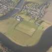
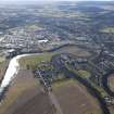
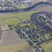
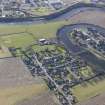
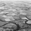
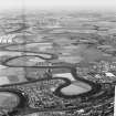
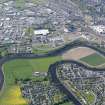
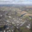
Cambuskenneth, General


Village (Period Unassigned)
Site Name Cambuskenneth, General
Classification Village (Period Unassigned)
Canmore ID 224079
Site Number NS89SW 124
NGR NS 80754 94139
Datum OSGB36 - NGR
Permalink http://canmore.org.uk/site/224079


- Council Stirling
- Parish Stirling
- Former Region Central
- Former District Stirling
- Former County Stirlingshire

