
Pricing Change
New pricing for orders of material from this site will come into place shortly. Charges for supply of digital images, digitisation on demand, prints and licensing will be altered.
North Sutor, Coast Battery, Operations Block


Operations Block (Second World War)
Site Name North Sutor, Coast Battery, Operations Block
Classification Operations Block (Second World War)
Alternative Name(s) Cromarty Defences; Fort North Sutor, Site No. 1
Canmore ID 224059
Site Number NH86NW 9.11
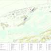
NGR NH 82129 69008
Datum OSGB36 - NGR
Permalink http://canmore.org.uk/site/224059


- Council Highland
- Parish Nigg (Ross And Cromarty)
- Former Region Highland
- Former District Ross And Cromarty
- Former County Ross And Cromarty
NH86NW 9.11 82129 69008
An underground, concrete and brick built operations block is situated about 122m E of WW II No.1 gun-emplacement. The entrance is down a set of stairs and there are two underground rooms, one with evidence of air extraction ducting.
Visited by RCAHMS (DE), August 2000
Note (29 July 2013)
The underground building has three rooms. At the bottom of the stairs a passageway leads off to the left and into a large room with air extraction ducting in the SE corner. The floor has cable ducts, and parts of what may the original flooring is still present. There is evidence of fixings on the E wall, possibly for a map. There are four ventilation holes in the roof.
The second room, which in turn leads to the smaller third room, is at the end of the passageway furthest from the stairs. The larger room was brick lined, perhaps at a later date, and appears to have been a communication/telephone exchange. There is some graffiti, including a Royal Artillery insignia on the S wall. The smaller room against the East side of the building may have been for electrical and telephone equipment.
Information from RCAHMS (AKK) 29 July 2013.
Field Visit (12 March 2019)
This underground operations block, which is deeply cut into an ESE-facing slope, formed part of the infrastructure of the battery introduced by the Army during World War 2. Upcast from the excavation has been piled to its ENE and SSE. The block measures 10.5m from NNW to SSE by 9.2m overall. It has a flat, reinforced cast concrete roof, waterproofed with a layer of bitumen above which are traces of the turf that was originally employed as camouflage. At least six circular vents convey air to the rooms below, while the rising ground to both the WSW and NNW is buttressed by a reinforced concrete wall that forms one side of a stairwell located at the building’s NW corner. The other sides of the stairwell are bordered by a lower, less substantial wall that retain traces of a metal safety rail. A flight of steps leads down to a whitewashed cement-rendered corridor that provides access to three compartments to its ENE. The largest compartment, occupying the NNW section of the building, is reached via a metal framed doorway situated at the foot of the steps. This leads directly into a second corridor, which is partly vented by an aperture protected by an iron cowl in the stairwell. This corridor runs NNW where an entrance leads into the compartment. Its walls and ceiling are whitewashed, while the floor is crossed by electrical cable ducts at right angles. There are no fittings, although the former presence of electrical equipment can be detected on the walls. A second doorway in the main corridor provides access to two further compartments occupying the SSE part of the building. The more westerly, which is brick-lined and whitewashed may have been a communications room. A small, but neat pencilled graffito on a single brick in the SSE wall depicts a field gun accompanied by the letters, ‘RA’ (Royal Artillery). An electrical cable duct adjacent to the NNW wall leads into a narrow, cement-rendered, whitewashed compartment, which also has ducts against both its NNW and ENE walls. Narrow robber trenches emerging at the NNE and SSE corners of the building indicate that electrical cables once ran down the slope towards both the Battery Observation Post (NH86NW 9.7) and the Fire Command Post (NH86NW 9.3).
Visited by HES, Survey and Recording (ATW, AKK), 12 March 2019.

