
Pricing Change
New pricing for orders of material from this site will come into place shortly. Charges for supply of digital images, digitisation on demand, prints and licensing will be altered.
Ardnamurchan, Tornamoine


Field System (Period Unassigned), Township (Period Unassigned)
Site Name Ardnamurchan, Tornamoine
Classification Field System (Period Unassigned), Township (Period Unassigned)
Canmore ID 22352
Site Number NM56SE 4
NGR NM 557 622
NGR Description Centred NM 557 622
Datum OSGB36 - NGR
Permalink http://canmore.org.uk/site/22352


- Council Highland
- Parish Ardnamurchan
- Former Region Highland
- Former District Lochaber
- Former County Argyll
NM56SE 4 centred on 557 622
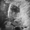
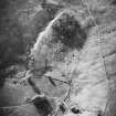
The township of Tornamona, centred NM 557 622, was cleared in 1882 by Sir James Milles Riddell. (c.17 roofless buildings shown on OS 6"map, Argyllshire, 2nd ed., 1900).
A MacKenzie 1946
Site not visited. Name 'Tornamoine' known locally.
Information from OS (N K B) 15 June 1970
This was a substantial settlement of a similar size to Bourblaige, over 24 buildings being shown on Bald's Estate map of 1806. Additional structures shown abandoned in 1875 at NM 5528 6190, NM 5550 6173 (two), and NM 5562 6201 were presumably part of the same settlement. It was probably cleared at the same time as Bourblaige. This has been a desk assessment area.
J Wordsworth, SSSIs, Scottish Natural Heritage, 1993
Twenty unroofed buildings, one of which is a long building of three compartments, a sheepfold and the fragmentary remains of a field-system (centred on NM 556 626) are depicted on the 1st edition of the OS 6-inch map (Argyllshire 1875, sheet xxv). Thirteen unroofed buildings, a two compartment enclosure and the field-system are shown on the current edition of the OS 1:10000 map (1974).
Information from RCAHMS (SAH) 6 May 1998

