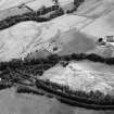
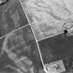
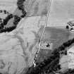
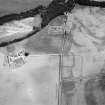
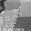
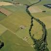
Stracathro Parish Church, Churchyard
Churchyard (18th Century)
Site Name Stracathro Parish Church, Churchyard
Classification Churchyard (18th Century)
Canmore ID 222309
Site Number NO66NW 10.01
NGR NO 61744 65752
NGR Description Centred on NO 61744 65752
Datum OSGB36 - NGR
Permalink http://canmore.org.uk/site/222309
- Council Angus
- Parish Stracathro
- Former Region Tayside
- Former District Angus
- Former County Angus
NO66NW 10.00 61733 65763
NO66NW 10.01 61744 65752 Parish Churchyard
For Stracathro Parish Manse (NO 6185 6541 and 6183 6537), see NO66NW 82.
(NO 6173 6575) Church (NAT)
(NO 6199 6581) Brawl's Well (NAT)
OS 6" map, (1959)
The modern parish church at Stracathro, built in 1799, occupies the site of its medieval predecessor, which was the church of the Chanter of Brechin Cathedral, and is described in 1799 as 'little better than a heap of ruins'. The alleged existence of a Celtic church here (Gilruth 1937) is based on the doubtful derivation of 'Brawl's' or 'St Brule's' Well from St Rule or Regulus. This was a healing well which was drained long before 1885 and the name is now lost. Two slabs, the larger being 8' to 9' long and 3' broad, lay to the north of the church in 1885.
They were traditionally said to cover two of the graves of three 'Danish generals'.
Statistical Account (OSA) 1792; J D Gilruth 1937; A J Warden 1880-5; Name Book 1860; G Hay 1957.
No early grave-slabs noted. At the site of the well is a natural spring running into a field drain. The site is thickly overgrown.
Visited by OS (J L D) 14 January 1958.
No further information regarding the medieval church. The modern church is still in use as is the burial ground which has been extended to the N. In the burial ground there are several 18th century grave stones. Two crude, prostrate slabs leaning against the church in the NE may be those referred to by Warden (1880-5). Brawl's Well is a natural spring emerging in a ditch.
Visited by OS (R L) 25 August 1971.
Note
Burial ground depicted on the 1st edition of the OS 25-inch map (1864). Current extent of graveyard defined / digitized from orthoimagery provided by Bluesky International Ltd. OS 1km map square NO6165 (Core ID 5180046) flown on 21 April 2023.
Information provided by HES (C DeDeo) 10 April 2024.


