
Following the launch of trove.scot in February 2025 we are now planning the retiral of some of our webservices. Canmore will be switched off on 24th June 2025. Information about the closure can be found on the HES website: Retiral of HES web services | Historic Environment Scotland
Stirling, 15 Upper Bridge Street, St Mary's R.c. Church


Church (19th Century)
Site Name Stirling, 15 Upper Bridge Street, St Mary's R.c. Church
Classification Church (19th Century)
Canmore ID 221386
Site Number NS79SE 523
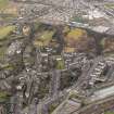
NGR NS 79347 94009
Datum OSGB36 - NGR
Permalink http://canmore.org.uk/site/221386


- Council Stirling
- Parish Stirling
- Former Region Central
- Former District Stirling
- Former County Stirlingshire
Note (28 March 2025)
A church is depicted on the 3rd edition of the OS 25-inch map (1918) - Stirlingshire nXVII.3.
Information from HES (D Watson) 28 March 2025

