
Pricing Change
New pricing for orders of material from this site will come into place shortly. Charges for supply of digital images, digitisation on demand, prints and licensing will be altered.
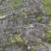
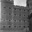
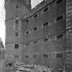
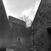
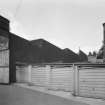
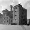
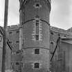
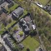
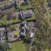
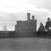
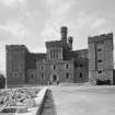
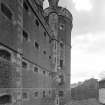
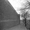
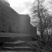
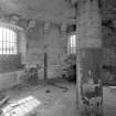
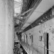
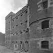
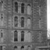
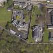
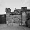
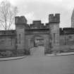
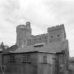
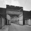
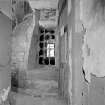
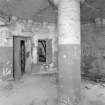
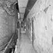
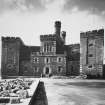
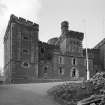
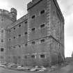
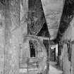
Stirling, 31 St John Street, Old Town Jail


Hospital (First World War), Prison (19th Century), Prison (First World War)
Site Name Stirling, 31 St John Street, Old Town Jail
Classification Hospital (First World War), Prison (19th Century), Prison (First World War)
Alternative Name(s) Old Military Prison; Military Detention Barracks
Canmore ID 221259
Site Number NS79SE 177
NGR NS 79233 93615
Datum OSGB36 - NGR
Permalink http://canmore.org.uk/site/221259


- Council Stirling
- Parish Stirling
- Former Region Central
- Former District Stirling
- Former County Stirlingshire
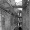
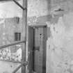
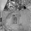
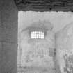
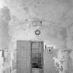
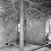
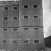
The new town prison for Stirling was designed by Thomas Browne, Scotland's leading prisoner designer, and was opened on 11 November 1847. In the 1880s it was possible to transport prisoners further by rail and fewer, larger prisons were needed. The Army took over Stirling Prison as the main detention barracks for Scotland. The Army retained the building until 1935.
During the First World War there was a small specialist Venereal Disease unit for infected inmates.
Information from HS/RCAHMS World War One Audit Project (GJB) 12 September 2013.
NS79SE 177.00 79233 93615
NS79SE 177.01 792 937 Watching Brief
Non-Guardianship Sites Plan Collection, DC28605, 1889.
NMRS REFERENCE:
Architect: Thomas Brown 1843-7
EXTERNAL REFERENCE:
Scottish Record Office
Conversion of the Old Prison into a Court room for the Sheriff and offices.
Proposed purchase by the County from the town for this purpose.
Letter from John Murray (of Polmaise) to John Murray, his son.
1855 GD 189/2/1007
EXTERNAL REFERENCE:
Scottish Record Office
RHP 21641 - 21678 Thomas Brown 1843-47 Plans, elevations, sections and details
RHP 21680
RHP 21683 - 21688
EXTERNAL REFERENCE:
National Library
5th Report of the General Board of Directors of Prisons in Scotland 1844
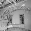
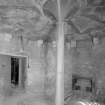
Photographic Survey (April 1965)
Photographic survey by the Scottish National Buildings Record/Ministry of Works in 1965.
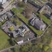
Excavation (1993)
An investigation was conducted, in advance of car park development, to the rear of the old military prison.
The site appears as two flattened, split level areas, the northern half being c.1.2m higher than the southern.
Trial trenching revealed that the northern half of the site had been built up in the 19th century, possibly contemporary with the construction of the prison. Make-up deposits, c.1m in depth, overlay weathered doleritic sill bedrock, creating a terraced effect. Trenches in the southern half of the site revealed a shallower topsoil, depth of c0.5m, overlying weathered bedrock. A garden soil type deposit containing 15th-century pottery was also encountered. This deposit occurred in pockets in the bedrock and may represent an attempt to terrace the area during this period.
Sponsor: Stirling District Council
J MacKenzie 1993
Project (March 2013 - September 2013)
A project to characterise the quantity and quality of the Scottish resource of known surviving remains of the First World War. Carried out in partnership between Historic Scotland and RCAHMS.

