
Dun Nan Gall, Mull


Dun (Period Unassigned)
Site Name Dun Nan Gall, Mull
Classification Dun (Period Unassigned)
Canmore ID 22113
Site Number NM45SW 3
NGR NM 4008 5311
Datum OSGB36 - NGR
Permalink http://canmore.org.uk/site/22113


- Council Argyll And Bute
- Parish Kilninian And Kilmore
- Former Region Strathclyde
- Former District Argyll And Bute
- Former County Argyll
NM45SW 3 4008 5311.
(Name: NM 4003 5309) Dun nan Gall (NR)
OS 1:10000 map (1976)
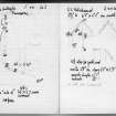
Dun, Dun nan Gall: On the summit of a rocky knoll about 800m S of Croig farmhouse there are the denuded remains of a dun which measures internally about 26m from NW to SE by 13.5m transversely. The NE flank of the knoll is protected by sheer rock-faces 9m high, but on the SW the cliffs diminish in height, and in the middle of that side grassy slopes offer comparatively easy access to the summit. There are no traces of defences on the NE, where the natural strength of the knoll rendered aritificial protection unnecessary, but on all other sides the dun has been defended by a dry-stone wall, now reduced to a low grass-grown band of core material not more than 3m thick, in which several stones of both faces can still be seen. The entrance is situated on the NW, the wall terminals being staggered on each side, presumably because the margin of the summit severely indented at this point; a modern dry-stone wall has been built across its mouth.
RCAHMS 1980, visited 1972
NM 4008 5311. Dun nan Gall, the remains of a dun as described by the RCAHMS. (Although this dun was surveyed at 1:2500 scale, the plan was subsequently down-graded, and the detail was not published on the 1:10,000 plan).
Visited by OS (JP) 16 June 1972
Site recorded during fieldwork by the staff of the Strathclyde Joint Archaeology Service
NM 4000 5318 Dun
Strathclyde Regional Council SMR 1995
Field Visit (1 July 1943)
This site was included within the RCAHMS Emergency Survey (1942-3), an unpublished rescue project. Site descriptions, organised by county, vary from short notes to lengthy and full descriptions and are available to view online with contemporary sketches and photographs. The original typescripts, manuscripts, notebooks and photographs can also be consulted in the RCAHMS Search Room.
Information from RCAHMS (GFG) 10 December 2014.

