Pricing Change
New pricing for orders of material from this site will come into place shortly. Charges for supply of digital images, digitisation on demand, prints and licensing will be altered.
Upcoming Maintenance
Please be advised that this website will undergo scheduled maintenance on the following dates:
Thursday, 9 January: 11:00 AM - 3:00 PM
Thursday, 23 January: 11:00 AM - 3:00 PM
Thursday, 30 January: 11:00 AM - 3:00 PM
During these times, some functionality such as image purchasing may be temporarily unavailable. We apologise for any inconvenience this may cause.
Dun Auladh, Mull
Dun (Period Unassigned)
Site Name Dun Auladh, Mull
Classification Dun (Period Unassigned)
Canmore ID 22105
Site Number NM45SW 2
NGR NM 4081 5212
Datum OSGB36 - NGR
Permalink http://canmore.org.uk/site/22105
- Council Argyll And Bute
- Parish Kilninian And Kilmore
- Former Region Strathclyde
- Former District Argyll And Bute
- Former County Argyll
NM45SW 2 4081 5212.
(Name: NM 4080 5211) Dun Auladh (NR)
OS 1:10000 map (1976)
Dun, Dun Auladh: On a low rocky knoll situated 340m SSE of Druimghigha, between the Allt Torr a' Bhacain and the Allt Dun Auladh, there is a dun, measuring 15.3m by 7m within a wall about 2.4m thick. The E side of the knoll is a sheer rock-face rising 9m in greatest height, but the W side is, by contrast, a grassy slope little more then 2m high. The wall has been largely reduced to a substantial spread of rubble core-material, but a number of massive facing-stones, forming the lowest course of each face, survive on the SW. The entrance was probably situated on the WSW, where for a short distance the spread of rubble is thinner than elsewhere. The interior is overgrown by heather and scrub. RCAHMS 1980, visited 1972
NM 4081 5212. Dun Auladh, the remains of an oval dun, as described by the RCAHMS. (Although this dun was surveyed at 1:2500 scale, the plan was subsequently down-graded, and the detail was not published on the 1:10,000 plan).
Visited by OS (RD) 16 June 1972
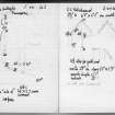
Field Visit (8 June 1934)
Dun, Drumgigha.
An isolated rock along edge of cliff (old croft at base), traces of wall only visible.
Visited by VG Childe 8 June 1934.
Notes and typescript filed with RCAHMS Emergency Survey material.
Field Visit (1 July 1943)
This site was included within the RCAHMS Emergency Survey (1942-3), an unpublished rescue project. Site descriptions, organised by county, vary from short notes to lengthy and full descriptions and are available to view online with contemporary sketches and photographs. The original typescripts, manuscripts, notebooks and photographs can also be consulted in the RCAHMS Search Room.
Information from RCAHMS (GFG) 10 December 2014.


