
Pricing Change
New pricing for orders of material from this site will come into place shortly. Charges for supply of digital images, digitisation on demand, prints and licensing will be altered.
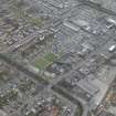
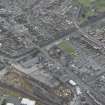
Grangemouth, Bo'ness Road, Dundas Church And Hall


Church (19th Century), Hall (19th Century)
Site Name Grangemouth, Bo'ness Road, Dundas Church And Hall
Classification Church (19th Century), Hall (19th Century)
Alternative Name(s) Dundas Up Church; United Presbyterian
Canmore ID 220941
Site Number NS98SW 75
NGR NS 92913 81991
Datum OSGB36 - NGR
Permalink http://canmore.org.uk/site/220941


- Council Falkirk
- Parish Grangemouth
- Former Region Central
- Former District Falkirk
- Former County Stirlingshire
Note (30 January 2025)
A church is depicted on the 2nd edition of the OS 6-inch map (1899) -Stirlingshire Sheet XXV.SW
Information from HES (C Forman) 30 January 2025

