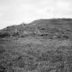
Eilean Na H-ordaig, Mull
Dun (Period Unassigned)
Site Name Eilean Na H-ordaig, Mull
Classification Dun (Period Unassigned)
Alternative Name(s) Dun An Aird
Canmore ID 21989
Site Number NM42NE 2
NGR NM 4976 2811
Datum OSGB36 - NGR
Permalink http://canmore.org.uk/site/21989
- Council Argyll And Bute
- Parish Kilfinichen And Kilvickeon
- Former Region Strathclyde
- Former District Argyll And Bute
- Former County Argyll
NM42NE 2 4976 2811.
(NM 4976 2811) Dun (NR)
OS 1:10000 map (1976)
Dun, Eilean na h-Ordaig: This dun occupies the summit of a low rocky knoll on the tidal islet of Eilean na h-Ordaig, just off the N shore of Loch Scridain. On the SW the position is protected by a rock face about 2.8m high, but on all other sides the immediate approach to the dun is over gently sloping or comparatively level ground.
Roughly circular on plan, the dun measures approximately 18m in diameter within a dry-stone wall from 2.7m to 4.3m thick. The wall now appears as a largely grass- covered stony bank, which stands at least 2m above the level of the interior. The line of the inner face can be traced round most of the perimeter; only a few short stretches and isolated stones of the outer face can be seen. There are two entrances, situated on the NNW and SE respectively. The interior of the dun is obscured by a dense growth of scrub, which in turn masks a great mass of stony debris, possibly the foundations of relatively recent structures.
The dun has been further protected by a stone wall drawn in an irregular curve round the NE half and continued along the edge of the low cliff to abut against the outer face of the dun wall on the W and SW respectively. This outer wall now appears in most places as a stony scarp or bank up to 1m high, in which several stones of both the inner and outer face have survived in situ, indicating an original thickness varying from about 1.5m to 2m There were probably two entrances, one now represented by the gap 2.4m wide on the N, the other by a slight depression in the bank on the SE, opposite the southern most entrance of the dun. The relatively good preservation of the out-work is particularly remarkable when compared with that of the outer face of the dun wall, and it may indicate that in a secondary phase the defensive character of the dun itself was abandoned in favour of a more domestic use, as at the broch Dun Mor, Vaul (NM04NW 3).
RCAHMS 1980, visited 1974
Surveyed at 1:2500.
Visited by OS (DWR) 25 May 1972
Field Visit (25 July 1942)
This site was recorded as part of the RCAHMS Emergency Survey, undertaken by Angus Graham and Vere Gordon Childe during World War 2. The project archive has been catalogued during 2013-2014 and the material, which includes notebooks, manuscripts, typescripts, plans and photographs, is now available online.
Information from RCAHMS (GF Geddes) 4 December 2014.


