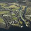
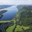
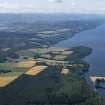
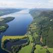
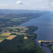
Accessibility

Font Size

100% 150% 200%

Background Colour

Default Contrast
Close Reset

Loch Ness

General View (Period Unassigned)

Site Name Loch Ness

Classification General View (Period Unassigned)

Canmore ID 217311

Site Number NH52NW 37

NGR NH 53 29

NGR Description Centred NH 53 29

Datum OSGB36 - NGR

Permalink http://canmore.org.uk/site/217311

Ordnance Survey licence number AC0000807262. All rights reserved.
Canmore Disclaimer. © Bluesky International Limited 2025. Public Sector Viewing Terms

Toggle Aerial | View on large map

Digital Images

Oblique aerial view of Loch Ness and Urquhart Castle, taken from the SW.
Oblique aerial view of Loch Ness and Urquhart Castle, taken from the SW.Fort Augustus and Loch Ness. 
General oblique aerial view of the village centred on the road bridges, swing bridge, locks, abbey and schools, taken from the E.Oblique aerial view.Oblique aerial view.Oblique aerial view.Oblique aerial view of Loch Ness and Urquhart Castle, taken from the SSW.Oblique aerial view of Loch Ness and Urquhart Castle, taken from the S.Oblique aerial view.

Administrative Areas

  • Council Highland
  • Parish Urquhart And Glenmoriston
  • Former Region Highland
  • Former District Inverness
  • Former County Inverness-shire

References

MyCanmore Image Contributions


Contribute an Image

MyCanmore Text Contributions