
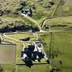
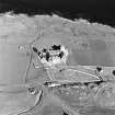
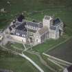
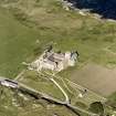
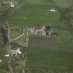
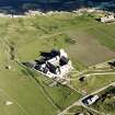
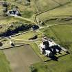
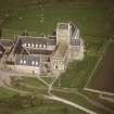
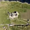
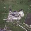
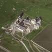
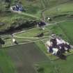
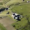
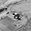
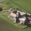
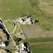
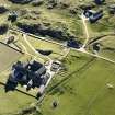
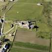
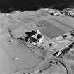
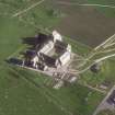
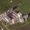
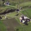
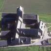
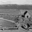
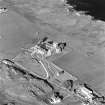
Iona, Reilig Odhrain


Ditch(S) (Period Unassigned)
Site Name Iona, Reilig Odhrain
Classification Ditch(S) (Period Unassigned)
Canmore ID 21658
Site Number NM22SE 41
NGR NM 2862 2448
Datum OSGB36 - NGR
Permalink http://canmore.org.uk/site/21658


- Council Argyll And Bute
- Parish Kilfinichen And Kilvickeon
- Former Region Strathclyde
- Former District Argyll And Bute
- Former County Argyll
NM22SE 41 2862 2448.
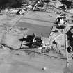
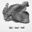
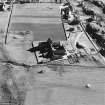
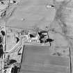
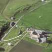
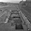
Three prehistoric ditches, obviously artificial, were excavated by Barber (1982) in 1979. They may have been dug for drainage or as enclosures for fields or settlements. (Ditches A, B and C on plan.)
J W Barber 1982.
External Reference (28 October 2011)
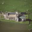
Scheduled as element within 'The monument known as St Mary's Abbey, Iona, monastic settlement [comprising] the remains of the large early historic monastic settlement founded by St Columba in AD 563, St Martin's Cross, and parts of medieval buildings associated with the Benedictine Abbey of St Mary founded around AD 1200.'
Information from Historic Scotland, scheduling document dated 28 October 2011.
Excavation (21 February 2013)
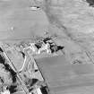
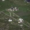
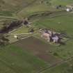
NM 2857 2447 The removal of an existing soakaway, to the E of the ticket office, exposed a 2.0 x 1.1m and 0.9m deep area. The area contained a 200mm deep deposit relating to modern landscaping, over a 300mm deep cultivated soil horizon, overlying a truncated horizon with cut features (none excavated).
Sponsor: Historic Scotland
D Murray 2013
Kirkdale Archaeology
Excavation (20 February 2013 - 11 April 2013)
NM 2856 2448 Signage, drainage and hard standing. Only two drainage trenches, running parallel to, and E of, the boundary dyke at the SW entrance, reached greater than 200mm. They measured 5.25m x 550mm and 8.50m x 400mm. Both were dug to a depth of c500mm and revealed a deep deposit of cultivated soils, below modern landscaping and services. The cultivated soils were c200mm deep, sealing a series of truncated cuts, associated with a crude metalled surface (unexcavated). The cultivation horizon is probably 19th- to early 20th-century in date.
Sponsor: Historic Scotland
D Murray 2013
Kirkdale Archaeology

