
Pricing Change
New pricing for orders of material from this site will come into place shortly. Charges for supply of digital images, digitisation on demand, prints and licensing will be altered.
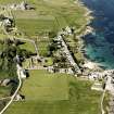
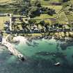
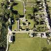
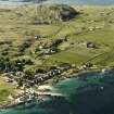
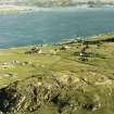
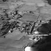
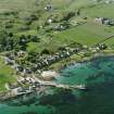
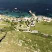
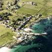
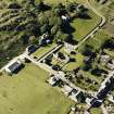
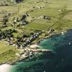
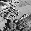
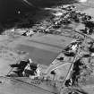
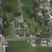
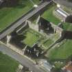
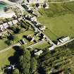
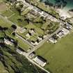
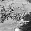
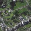
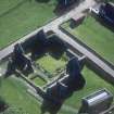
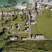
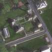
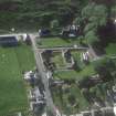
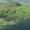
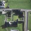
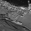
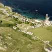
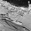
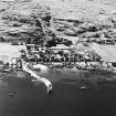
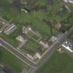
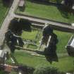
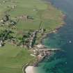
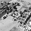
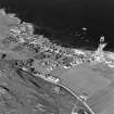
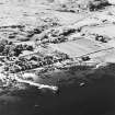
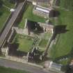
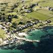
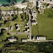
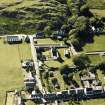
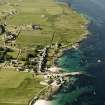
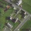
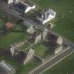
Iona, Martyr Street


Buried Land Surface (Period Unknown)(Possible), Road (Period Unassigned), Lithic Implement(S) (Prehistoric)
Site Name Iona, Martyr Street
Classification Buried Land Surface (Period Unknown)(Possible), Road (Period Unassigned), Lithic Implement(S) (Prehistoric)
Canmore ID 21622
Site Number NM22SE 15
NGR NM 2842 2409
NGR Description From NM 2842 2409 to NM 2856 2404
Datum OSGB36 - NGR
Permalink http://canmore.org.uk/site/21622


- Council Argyll And Bute
- Parish Kilfinichen And Kilvickeon
- Former Region Strathclyde
- Former District Argyll And Bute
- Former County Argyll
NM22SE 15 2842 2409 to 2856 2404.
(NM 2842 2409 - NM 2856 2404) Martyr Street (NR) (Site of)
OS 6" map, Argyllshire, 2nd ed., (1900)
The site of a short street supposed to have run from the end of the Nunnery to the beach at the south side of St Ronan's Bay. The present road occupies its course.
Name Book 1878.
ONB (1878) confirmed.
Visited by OS (JP) 8 June 1972.
Field Visit (April 1996 - May 1996)
The site of a short street supposed to have run from the end of the Nunnery to the beach at the south side of St Ronan's Bay. The present road occupies its course.
(ION96 087)
Information from NTS (SCS) January 2016
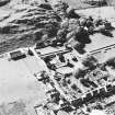
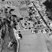
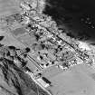
Watching Brief (25 July 2017)
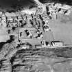
NM 28429 24052 A watching brief was undertaken during the machine excavation of four SI test pits and four percolation test pits, on 25 July 2017, at and around the current village hall, in advance of a funding application for a new village hall. A buried black silt loam soil and a yellow brown sandy silt were identified in three of the four percolation test pits and an over deepened topsoil, the base of which may be a buried soil, in two of the test pits. Struck lithics, possibly dating to the Neolithic period were recovered from the black silt loam in the three of the percolation test pits and a single lithic was recovered from topsoil in Test Pit 4.
Archive: NRHE
Funder: WT Architecture
Clare Ellis – Argyll Archaeology
(Source: DES, Volume 18)

