
Following the launch of trove.scot in February 2025 we are now planning the retiral of some of our webservices. Canmore will be switched off on 24th June 2025. Information about the closure can be found on the HES website: Retiral of HES web services | Historic Environment Scotland
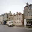
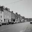
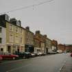
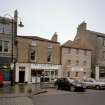
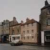
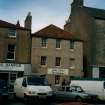
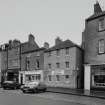
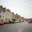
Dunbar, 126, 128 High Street


Museum (20th Century), Shop (Modern), Tenement (18th Century)
Site Name Dunbar, 126, 128 High Street
Classification Museum (20th Century), Shop (Modern), Tenement (18th Century)
Alternative Name(s) John Muir's Birthplace
Canmore ID 215934
Site Number NT67NE 362
NGR NT 67864 79004
Datum OSGB36 - NGR
Permalink http://canmore.org.uk/site/215934


First 100 images shown. See the Collections panel (below) for a link to all digital images.
- Council East Lothian
- Parish Dunbar
- Former Region Lothian
- Former District East Lothian
- Former County East Lothian
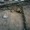
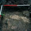
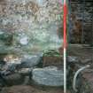
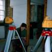
Excavation (July 2002 - October 2002)
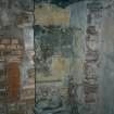
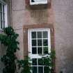
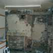
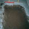
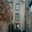
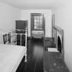
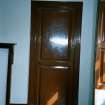
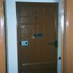
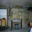
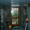
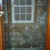
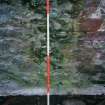
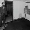
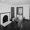
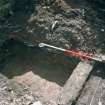
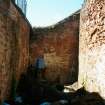
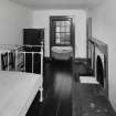
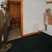
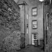
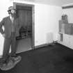
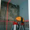
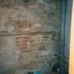
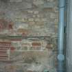
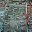
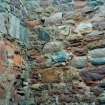
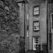
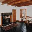
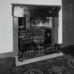
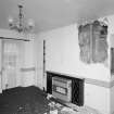
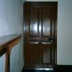
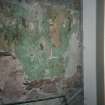
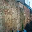
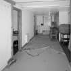
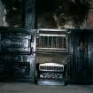
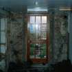
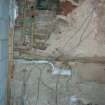
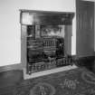
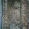
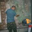
NT 678 790 The building dates to the late 18th century and is believed to be the birthplace and early home of the naturalist and founder of the conservation movement, John Muir. A historic building survey was undertaken in 2002 of the interior and of the upstanding walls which enclose a small garden to the rear of the building. An archaeological evaluation was also carried out. No archaeological sediments survived within the building but well-preserved deposits were present in the garden. This prompted the excavation of the entire garden area down to undisturbed natural subsoil.
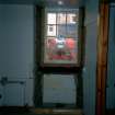
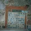
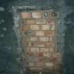
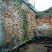
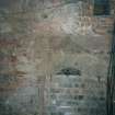
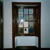
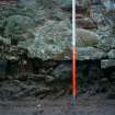
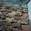
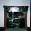
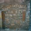
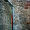
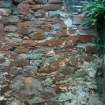
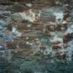
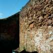
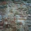
The building has undergone extensive structural alterations during the 20th century, leaving very little of its character as occupied by the Muir family. Several phases of building are evident in the walls enclosing the garden. A number of blocked openings including windows and doorways were recorded. The earliest phase, apparent in the N and S walls, may date to the 17th century.
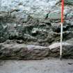
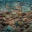
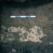
During the excavation in the garden, several phases of activity were identified. The earliest feature was a pit or possible ditch. It contained a substantial amount of charred oak, which may be the remains of a fence or timber lining, and a number of sherds of green-glazed pottery dated to the 14th/15th century. Above this feature a clay layer of unknown function covered the entire site. This was cut in several places by later features.
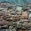
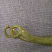
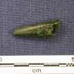
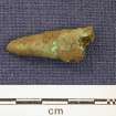
A cobbled surface was identified. This was bedded in marine sand from which a copper-alloy spur of 15th-century date was recovered. This surface covered much of the excavated area and formed either a road or courtyard, with a well-made gutter, that ran along the southern boundary of the site and issued into a culvert at its E end. This potentially drained under a building that fronted onto the High Street. Two clay-bonded walls were present, both of which ran parallel to the present property boundaries.
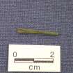
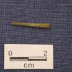
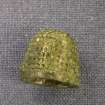
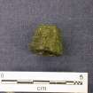
A large quantity of pottery was recovered from across the site, ranging in date from the 12th to the 19th centuries. The largest group can be dated to the 13th to 15th centuries. Several copper-alloy objects, including the spur, a thimble and a ferrule were also recovered, dating to the same period as the pottery. Animal bone, including sheep, pig and cattle, together with smaller mammals and frogs and some marine shell, was found. Small amounts of slag and iron were also present.
Archive to be deposited in the NMRS.
Sponsor: John Muir Trust.
J Morrison (Headland Archaeology) 2002

