
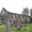
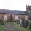
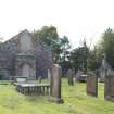
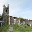
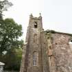
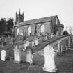
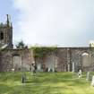
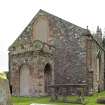
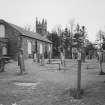
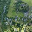
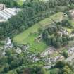
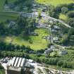
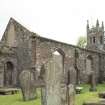
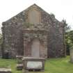
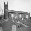
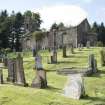
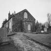
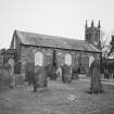
Tongland Parish Church


Burial Ground (19th Century), Church (19th Century)
Site Name Tongland Parish Church
Classification Burial Ground (19th Century), Church (19th Century)
Alternative Name(s) Tongland Church Of Scotland
Canmore ID 215036
Site Number NX65SE 349
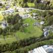
NGR NX 69794 53914
Datum OSGB36 - NGR
Permalink http://canmore.org.uk/site/215036


- Council Dumfries And Galloway
- Parish Tongland
- Former Region Dumfries And Galloway
- Former District Stewartry
- Former County Kirkcudbrightshire
See also:
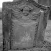
NX65SE 12 69768 53925 Tongland Old Parish Church (built on site of Tongland Abbey)
NX65SE 335 69723 53864 Former Tongland Manse (now Mansewood)
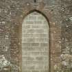
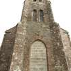
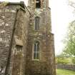
Rectangular neo-Gothic hall church with square tower to N and later vestry/porch to S gable. Sandstone rubble with polished red sandstone margins and dressings, all openings recently blocked with breeze-block. 3-bay buttressed body of church, hoodmoulded Tudor-arch windows. Slate roofs, sandstone skews. (Historic Scotland)
Note
Burial ground depicted on the 1st edition of the OS 6-inch map (1852). Current extent of graveyard defined / digitized from orthoimagery provided by Bluesky International Ltd. OS 1km map square NX6953 (Core ID 4320309) flown on 18 June 2021
Information from HES (C DeDeo) 20 March 2024

