
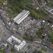
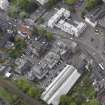
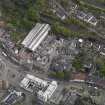
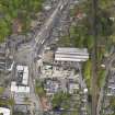
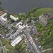
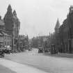
Linlithgow, High Street, General


Street (12th Century)
Site Name Linlithgow, High Street, General
Classification Street (12th Century)
Canmore ID 214837
Site Number NT07NW 235
NGR NT 00007 77083
NGR Description From NT 00490 77140 to NS 99608 77046
Datum OSGB36 - NGR
Permalink http://canmore.org.uk/site/214837


- Council West Lothian
- Parish Linlithgow
- Former Region Lothian
- Former District West Lothian
- Former County West Lothian
NT07NW 235 00007 77083
Linlithgow High Street runs across two map sheets, NT07NW to the E and NS97NE to the W.
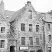
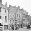
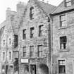
Photographic Survey (1956)
Photographs of 38-48 High Street, Linlithgow, West Lothian, by the Scottish National Buildings Record in 1956.

