
Tiree, Kenovay, Cill Fhinnein


Burial Ground (Period Unassigned), Chapel (Period Unassigned)
Site Name Tiree, Kenovay, Cill Fhinnein
Classification Burial Ground (Period Unassigned), Chapel (Period Unassigned)
Alternative Name(s) Kilfinnian Chapel
Canmore ID 21428
Site Number NL94NE 2
NGR NL 9934 4675
Datum OSGB36 - NGR
Permalink http://canmore.org.uk/site/21428


- Council Argyll And Bute
- Parish Tiree
- Former Region Strathclyde
- Former District Argyll And Bute
- Former County Argyll
NL94NE 2 9934 4675.
(NL 9934 4675) Cill Fhinnein (NAT) Chapel (NR) (rems of)
OS 1:10,000 map, (1977)
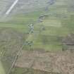
Chapel (possible) and Burial-ground, Kenovay: The remains of the former burial-ground of Kilfinnian comprise an enclosure of irregular pentagonal plan (q.v.) which is contained partly within a low stone-and-turf dyke and measures about 26 m in maximum length from E to W by about 19 m transversely. In the SE quarter of the enclosure there are the turf-covered remains of a small oblong building, partly surrounded by a scatter of boulders which may represent burial-markers. This building, which has rounded angles, measures 9.1 m in length by 5.9 m in width over walls some 0.8 m in thickness; no details of masonry construction are visible. The orientation of the building lends some support to its identification as a chapel (Name Book 1878; E Beveridge 1903) but its remains are otherwise untypical of structures of this class.
The burial-ground, which is marked on Turnbull's map of 1768, is said to have been used occasionally as a place of interment for still-born children, and it was reported at the beginning of this century that the latest burial had taken place some sixty years previously. The dedication was evidently to St Finnen.
RCAHMS 1980, visited 1973; Name Book 1878; E Beveridge 1903; W Reeves 1854.
When seen in 1972, the remains of the (?) chapel were in the same condition as that described by the RCAHMS, the walls standing up to 0.5m high. The burial-ground appeared as an area of disturbed ground.
Revised at 1:2500.
Visited by OS (D W R) 30 June 1972.

