Pricing Change
New pricing for orders of material from this site will come into place shortly. Charges for supply of digital images, digitisation on demand, prints and licensing will be altered.
Vatersay, Cornaig Bay
Chambered Cairn (Neolithic)
Site Name Vatersay, Cornaig Bay
Classification Chambered Cairn (Neolithic)
Alternative Name(s) Bhatarsaigh
Canmore ID 21400
Site Number NL69NW 8
NGR NL 63600 96987
Datum OSGB36 - NGR
Permalink http://canmore.org.uk/site/21400
- Council Western Isles
- Parish Barra
- Former Region Western Isles Islands Area
- Former District Western Isles
- Former County Inverness-shire
NL69NW 8 636 971
A round chambered cairn with polygonal chamber and passage on the SE. There is one divisional slab on the SW side of the chamber. Found by K Brannigan.
Information to A S Henshall from P Ashmore (IAM), July 1990.
Field Visit (9 May 2010)
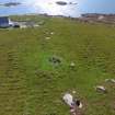
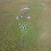
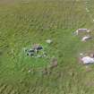
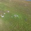
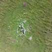
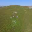
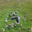
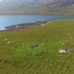
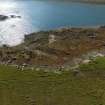
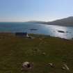
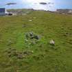
This small Hebridean chambered cairn is situated on a SE-facing slope above the rocky seashore. Slightly oval on plan, with what may be the remains of a low kerb surviving on the N, the cairn measures about 12.5m from NW to SE by 10m transversely, but it is heavily robbed and now stands to a height of no more than 0.6m. The chamber, which was reconstructed as a pen some time after the cairn was robbed, lies at the centre and is approached by a passage from the SE, where there is probably a shallow forecourt, though of the stones defining it only one boulder on the NE side seems to be in its original position, while on the SW a sloping slab beneath some other stones may also have been set up on edge. The passage, which comprises four stones roughly disposed in two opposed pairs, is some 1.7m long and widens from 0.6m at its entrance to 0.8m at its inner end. Its four stones range from a stumpy boulder 0.6m high on the NE side of the entrance to two roughly matched taller slabs forming the inner end, the western of which is 0.8m long by 0.25m thick and 0.9m high; the increase in height suggests that the roof may have risen into the chamber. The chamber measures 3.2m from NW to SE by 2.4m transversely, and retains at least four, and possibly five, stones in place, most of them being low boulders rising between 0.3m and 0.6m high above the turf, but including one much bigger block on the S measuring 1.8m in length by 0.4m in thickness and 0.8m in height. These four or five do not include a rather taller slab 0.9m high that has been set up to overlap the inner NW edge of the large block on the S, nor of a large slab that at first sight appears to subdivide the chamber. The former is apparently founded high in the cairn material and almost certainly relates to the conversion of the ruined chamber into a pen, as does the latter, which has been robbed from the chamber to form the greater part of the pen’s ESE side. Elsewhere traces of a tumbled stone wall can be detected, enclosing an area at the NW end of the chamber measuring 2.3m from NNE to SSW by 1.2m internally. Its entrance is at the E corner opening into the southern end of the chamber and probably accessed by way of the passage, at the inner end of which a step appears to have been inserted. The owner of the croft related a tradition that this was the site of a hen house belonging to the woman who formerly held the ground.
Visited by RCAHMS (SPH,SDB) 9 May 2010


