Pricing Change
New pricing for orders of material from this site will come into place shortly. Charges for supply of digital images, digitisation on demand, prints and licensing will be altered.
Newhall House, Habbie's Howe, Mary's Bower
Building (Period Unassigned), Hut (Period Unassigned)
Site Name Newhall House, Habbie's Howe, Mary's Bower
Classification Building (Period Unassigned), Hut (Period Unassigned)
Alternative Name(s) Rustick Hut
Canmore ID 213860
Site Number NT15NE 10.04
NGR NT 17308 56487
Datum OSGB36 - NGR
Permalink http://canmore.org.uk/site/213860
- Council Midlothian
- Parish Penicuik (Midlothian)
- Former Region Lothian
- Former District Midlothian
- Former County Midlothian
Field Visit (14 May 2014)
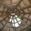
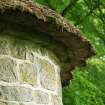
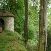
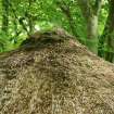
NT 17299 56500 Late 18th century circular ashlar stone structure with conical thatched roof. There are pointed arch openings and a pointed window that overlooks the North Esk river to the south. The roof appears fairly sound when viewed externally, however, upon entering the structure a large opening is visible in the thatch above, exposing the interior of the building to the elements. The remaining thatch is in a reasonable conditon, with some mossy vegetation growing throughout across the surface of the thatch. The timber elements of the roof, and the building in general, are currently in a stable condition, however, the roof is likely to deteriorate if it is not repaired soon. Although listed as being an ‘outbuilding’, the structure currently has no apparent use. The thatch is not netted.
Visited by Zoe Herbert (SPAB) 14 May 2014, survey no.136


