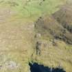
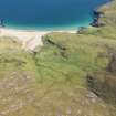
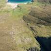
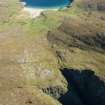
Mingulay Bay
Naust(S) (Period Unassigned)
Site Name Mingulay Bay
Classification Naust(S) (Period Unassigned)
Canmore ID 21353
Site Number NL58SE 14
NGR NL 5665 8313
Datum OSGB36 - NGR
Permalink http://canmore.org.uk/site/21353
- Council Western Isles
- Parish Barra
- Former Region Western Isles Islands Area
- Former District Western Isles
- Former County Inverness-shire
NL58SE 14 5665 8313.
3 seaward-facing structures, probably boat nausts, c. 5m above HWM with an expanse of smooth gently-sloping rock to seaward. The nausts are composed of upright slabs up to 0.7m high.
C B Buxton 1981.
There are two stone-lined boat nausts lying side-by-side above the high water mark on the south side of Mingulay Bay. The nausts, which lie end-on to the sea on the ENE are defined by orthostatic stones and measure 5.5m by 2.7m and 6.3m by 2.6m respectively. Both are open to the ENE. This site has been previously identified by Buxton (1981) and latterly by Branigan and Foster (2000).
MING03 277-8
Visited by RCAHMS (PJD) 26 June 2004
Field Visit (1981)
3 seaward-facing structures, probably boat nausts, c. 5m above HWM with an expanse of smooth gently-sloping rock to seaward. The nausts are composed of upright slabs up to 0.7m high.
C B Buxton 1981.
Field Visit (26 June 2004)
There are two stone-lined boat nausts lying side-by-side above the high water mark on the south side of Mingulay Bay. The nausts, which lie end-on to the sea on the ENE are defined by orthostatic stones and measure 5.5m by 2.7m and 6.3m by 2.6m respectively. Both are open to the ENE. This site has been previously identified by Buxton (1981) and latterly by Branigan and Foster (2000).
MING03 277-8
Visited by RCAHMS (PJD) 26 June 2004


