
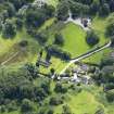
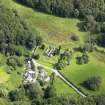
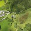
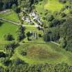
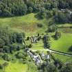
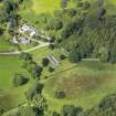
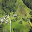
Anwoth, Old School House


Schoolhouse (Period Unassigned)
Site Name Anwoth, Old School House
Classification Schoolhouse (Period Unassigned)
Alternative Name(s) Anwoth Schoolhouse
Canmore ID 213399
Site Number NX55NE 150
NGR NX 58217 56201
Datum OSGB36 - NGR
Permalink http://canmore.org.uk/site/213399


- Council Dumfries And Galloway
- Parish Anwoth
- Former Region Dumfries And Galloway
- Former District Stewartry
- Former County Kirkcudbrightshire
NX55NE 150 58217 56201
Old School House [NAT]
OS (GIS) MasterMap, July 2009.
Location formerly entered in error as NX 58219 57201.

