Pricing Change
New pricing for orders of material from this site will come into place shortly. Charges for supply of digital images, digitisation on demand, prints and licensing will be altered.
Upcoming Maintenance
Please be advised that this website will undergo scheduled maintenance on the following dates:
Thursday, 9 January: 11:00 AM - 3:00 PM
Thursday, 23 January: 11:00 AM - 3:00 PM
Thursday, 30 January: 11:00 AM - 3:00 PM
During these times, some functionality such as image purchasing may be temporarily unavailable. We apologise for any inconvenience this may cause.
Stone Of Odin
Standing Stone (Prehistoric)
Site Name Stone Of Odin
Classification Standing Stone (Prehistoric)
Alternative Name(s) Ring Of Stenness
Canmore ID 2128
Site Number HY31SW 40
NGR HY 306 126
Datum OSGB36 - NGR
Permalink http://canmore.org.uk/site/2128
- Council Orkney Islands
- Parish Stenness
- Former Region Orkney Islands Area
- Former District Orkney
- Former County Orkney
HY31SW 40 306 126.
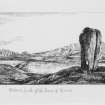
The Stone of Odin. This stone formerly stood about 150yds. north of the Ring of Stenness (HY31SW 2) but was destroyed in 1814 by the tenant of the farm. It is said to have been about 8 ft. high and was pierced through by a hole at about 5 ft. from the ground. Up to the time of its destruction it was customary to leave some offering on visiting the stone, such as a piece of bread, or cheese, or a rag, or even a stone. It was also considered that a promise made while the plighting parties grasped their hands through the hole was peculiarly sacred.
RCAHMS 1946, visited 1928.
The 'John O'Groat Journal' in 1849 gives a brief description of the site.
M Howe 2006
Orkney Smr Note
The site of the Odin Stone was pointed out to me by a man who had looked through it in his youth; it stood about 150 yards to the N of the Ring of Stenness,...All that can now be known of it must be learnt from Barry's or the Marchioness of Stafford's drawings, for the unfortunate tenant of Barnhouse cleared it away. The stone, which was much the same shape as those still left, was remarkable from being pierced through by a hole at about 5ft from the ground; the hole was not central but nearer to one side. Many traditions were connected with this stone'. (i.e. curing properties, sacred, etc.) [R1]
More or less as previous authority. The passage gives possible location. The hole is described as round... the hole was not in the centre but towards the side next the loch. [R2]
The stone was destroyed in 1814. Text quotes Thomas and other authorities. [R3]
When it was standing, the dimensions of the Stone of Odin were, about 8ft high x 3.5ft broad, with the hole 3ft from the ground. It was broken in December 1814, by Capt Mackay, tenant of the lands of Stenness. One piece, about 5ft long and from 2-2.5ft wide survived until it was broken up by a farmer's son in 1940. Marwick gives full details of the Stone's history and traditions. [R4]
There are some suggestions regarding the location of the 'Stone of Odin'. Ernest Marwick quotes F H Walden's findings, '92m N of Stenness Circle and 76m SE of the Watch Stone'. In practice, I found these figures to be wrong as the points do no meet. When the lines were extended until they did, the position of the stone was too far S according to other reports. In Fraser's paper he mentions bearings taken from F W L Thomas' map of1849, 'from the centre of the circle - 18x W of N,... Watch Stone - 18xE of N.' At first glance these figures
seem to be promising, because compass bearings are more accurate than distances, which are open to a certain degree of error. However, this information can be interpreted in different ways:-
(1) Fraser could have interpreted the bearings from Thomas' map himself, thus rendering them invalid.
(2) Thomas did actually record them therefore they would be valid, but we are not told if 'North' is 'True North', 'Magnetic North' circa 1849, or 'Magnetic North' circa 1925. When assuming 'North' to be 'True', the result was that the stone would have been in Harray Loch. IGS March 1987.
Excavation in 1991 by Dr Colin Richards located the probable position and socket for the Odin Stone complete with stone packing. The stone socket was an oval feature measuring 1.7m by 1.38m by 0.7m deep. Natural bedrock formed the base of the socket. This was situated c.7m SE of another similar stone socket excavated in 1988, perhaps implying that the Stone of Odin was one of a pair of standing stones aligned with the entrance to the Stones of Stenness and forming part of an avenue.
Information from Orkney SMR [n.d.]


