
Pricing Change
New pricing for orders of material from this site will come into place shortly. Charges for supply of digital images, digitisation on demand, prints and licensing will be altered.
Peterhead, South Road, Old St Peter's Church


Church (18th Century)
Site Name Peterhead, South Road, Old St Peter's Church
Classification Church (18th Century)
Alternative Name(s) Old Parish Church
Canmore ID 21193
Site Number NK14NW 2
NGR NK 12647 46055
Datum OSGB36 - NGR
Permalink http://canmore.org.uk/site/21193


- Council Aberdeenshire
- Parish Peterhead
- Former Region Grampian
- Former District Banff And Buchan
- Former County Aberdeenshire
NK14NW 2.00 12647 46055
NK14NW 2.01 12638 46033 Churchyard
See also NK14NW 5 Churchyard, Structures
For adjacent former manse (now Kirkburn House), see NK14NW 177.
(NK 1264 4605) St. Peter's Church (NR) (Remains of)
OS 6" map, (1938).
The Bell Tower of St. Peter's Church was built about the year 1647.
W Anderson 1865
The remains of St Peter's Church consist of the side walls and entire arch of the chancel and a square tower projecting outwards in the centre of the west wall of the nave. The tower and west wall are late but the chancel arch is Norman (MacGibbon and Ross 1896-7). The east wall and the chancel arch are 13th century (Aitken 1890). St Peter's Church is mentioned in 1132 and 1218 but these references are described as suppositional by McGibbon and Ross.
D MacGibbon and T Ross 1896-7; Aitken 1890.
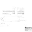
The remains of St. Peter's Church are as described above. The chancel walls are 0.8 metre thick and 3.8 metres maximum height. A fragment of the NE wall and the footings of part of the SW wall of the nave are evident, being 0.8 metre thick in places.
The bell tower, in good condition is 4.4 metres square.
Visited by OS (EGC) 29 November 1962.
No change.
Visited by OS (RL) 17 December 1968.
Publication Account (1982)
About 1132 the church of St. Peter was gifted by the Mormaer Gartnait and the Lady Eve to the monastery of Deer (Neish, 1950, 6). Others claim that the date of the grant was 1218 (Aitken, 1887-1890, 150; Findlay, 1933, 23), and up until that point St. Peter's was part of the endowments of the Bishopric of Dunkeld. The charter evidence on which the latter date is based is not known now to exist (MacGibbon and Ross, 1896, i, 372), and therefore it is impossible to say exactly what St. Peter's connection with the Cistercian Abbey of Deer was. The remains of the church consist of side walls of the chancel and the entire chancel arch, with a square tower projecting outwards in the centre of the west wall of the nave (MacGibbon and Ross, 1896, i, 371). The east wall and chancel arch have been dated to the thirteenth century, while the bell tower dates only to 1647.
By 1770 the church at Kirktown was in a ruinous condition and a second parish church was built and opened about 1771 immediately opposite the old Drill Hall, on a site sometimes occupied by a fish curing station (Neish, 1950, 108). Within the space of a few years, this church was abandoned because of weak foundations and an insufficient roof. In a magnanimous gesture of Christian unity, the Episcopalians allowed the Presbyterians use of their meeting house until another parish church was completed in 1806.
Information from ‘Historic Peterhead: The Archaeological Implications of Development’ (1982).

