
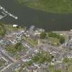
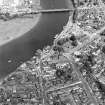
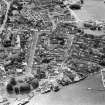
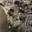
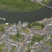
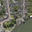
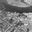
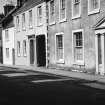
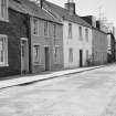
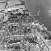
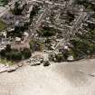
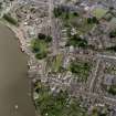
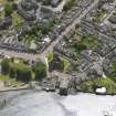
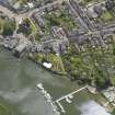
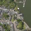
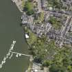
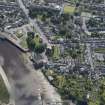
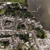
Kirkcudbright, High Street, General


General View (Period Unassigned)
Site Name Kirkcudbright, High Street, General
Classification General View (Period Unassigned)
Canmore ID 211767
Site Number NX65SE 189
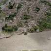
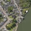
NGR NX 68078 50911
NGR Description From NX 68196 51090 to NX 68311 50795
Datum OSGB36 - NGR
Permalink http://canmore.org.uk/site/211767


- Council Dumfries And Galloway
- Parish Kirkcudbright
- Former Region Dumfries And Galloway
- Former District Stewartry
- Former County Kirkcudbrightshire
NX65SE 189 68078 50911 From NX 68196 51090 to NX 68311 50795
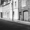
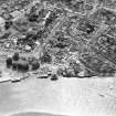
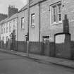
Photographic Survey (1959)
Photographs of buildings on High Street, Kirkcudbright, by the Ministry of Works c1959.
Photographic Survey (June 1964)
Photographic survey of buildings in Kirkcudbright, by the Scottish National Buildings Record in June 1964.
Publication Account (1978)
High Street contains a number of fine eighteenth-century dwellings, including the splendid townhouse of the Murray family, Broughtoun House (MacLeod, 1973, 23). Closes, which Heron wrote of, line High street at right angles and lead to outbuildings. A fifteenth-century font stands in the garden of the Selkirk Arms Hotel which has been a hostelry since 1777. The font, which possibly comes from Dundrennan Abbey has been variously used; as a water trough for rain water, a stepping stone, and in an outhouse at Bombie (MacLeod, 1973, 27).
Information from ‘Historic Kirkcudbright: The Archaeological Implications of Development’ (1978).

