
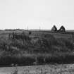
Rattray, St Mary's Chapel And Graveyard


Burial Ground (Medieval), Chapel (Medieval)
Site Name Rattray, St Mary's Chapel And Graveyard
Classification Burial Ground (Medieval), Chapel (Medieval)
Alternative Name(s) Old Rattray
Canmore ID 21090
Site Number NK05NE 2
NGR NK 08507 57530
Datum OSGB36 - NGR
Permalink http://canmore.org.uk/site/21090


- Council Aberdeenshire
- Parish Crimond
- Former Region Grampian
- Former District Banff And Buchan
- Former County Aberdeenshire
NK05NE 2 08507 57530
(NK 0850 5752) St Mary's Chapel (NR)
OS 6" map, (1959)
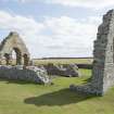
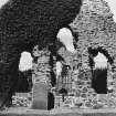
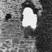
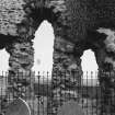
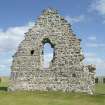
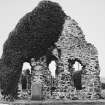
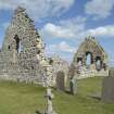
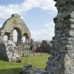
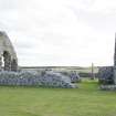
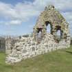
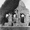
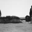
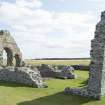
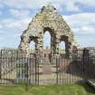
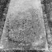
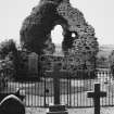
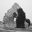
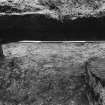
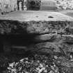
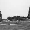
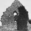
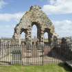
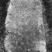
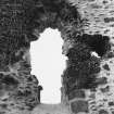
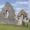
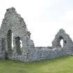
The ruins of St Mary's Chapel, measure internally 45ft E-W by 18ft 9in N-S with walls 3ft thick. The gables are nearly entire and a considerable portion of the side walls remain (MacGibbon and Ross 1896-7). The earliest notice of the chapel is between 1214 and 1233, when, according to the New Statistical Account (NSA, 1845), it was a pirvate chapel of the nearby castle (NK05NE 4). Milne (1901) suggests that the style of the arch of the E window is late 12th century (Milne 1901).
NSA 1845; D MacGibbon and T Ross 1896-7; J Milne 1901.
St Mary's Chapel is generally as described. The E gable has three lancet windows.
Visited by OS (RL) 8 January 1968.
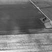
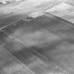
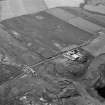
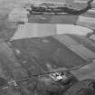
Visible on air photograph AAS/93/15/G30/31. Copy held by Grampian Regional Council.
Information from M Greig, Grampian Regional Council, March 1994.
Photographic Survey (19 August 2013)
Photographed on behalf of the Buildings of Scotland publications 2013-14.

