
Pricing Change
New pricing for orders of material from this site will come into place shortly. Charges for supply of digital images, digitisation on demand, prints and licensing will be altered.
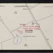
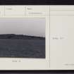
Cairn Catto


Cist(S) (Period Unassigned), Long Cairn (Neolithic), Axehead(S) (Stone)(Period Unassigned)
Site Name Cairn Catto
Classification Cist(S) (Period Unassigned), Long Cairn (Neolithic), Axehead(S) (Stone)(Period Unassigned)
Alternative Name(s) Cairncatto
Canmore ID 21054
Site Number NK04SE 3
NGR NK 0742 4213
Datum OSGB36 - NGR
Permalink http://canmore.org.uk/site/21054


- Council Aberdeenshire
- Parish Longside
- Former Region Grampian
- Former District Banff And Buchan
- Former County Aberdeenshire
NK04SE 3 0742 4213.
(NK 0742 4213) Cairn Catto (NR).
OS 6" map, (1959).
A long cairn, a great mound of bare stones, some of considerable size. In spite of much disturbance the plan is fairly clear, giving a length of 157' NW-SE and a breadth of 73' across the SE end, which is straight with rounded corners, and 22' across the square NE end to which the sides taper regularly.
The cairn stands 6' high at the SE end gradually diminishing in height to the NW.
The SW side has been much robbed from near the SE end for about one-third of its length. The NE side is well defined and appears to have been little disturbed. Various deep holes have been made in the SE end by pulling away the stones but no internal structure is to be seen. There may have been cists visible in it formerly.
Two stone axes found at the cairn in 1885 are in the Arbuthnot Museum, Peterhead.
A S henshall 1963; 1972; F R Coles 1904.
Cairn Catto (name confirmed), a long cairn, c.2.0m high at the SE end, c.1.3m high at the NE end, is generally as described by Henshall. The axes are still in the Arbuthnot Museum.
Surveyed at 1:2500.
Visited by OS (RL) 23 May 1972.
Publication Account (1986)
Although the plan of this great wedge-shaped long cairn is rather disturbed, it is still an important feature of the Buchan landscape, lying at 80 m OD in very open, rolling country. The cairn is built of many heavy stones, still bare, and is aligned NW-SE. It is 48 m long and higher and wider at the rounded southeastern end, which is 22 m across and 1.8 m high.
Information from ‘Exploring Scotland’s Heritage: Grampian’, (1986).
Field Visit (14 February 2002)
NK04SE 3 0742 4213.
This long cairn lies within a fenced enclosure on the leading edge of an open terrace. Standing up to 1.5m in height, it measures at least 42m in length and tapers in breadth towards the NW. At its SE end, it measures 14m in breadth by 1.6m in maximum height, but the NW end is masked by dense gorse, and no measurement could be obtained; the precise position of the end of the cairn was also obscured and it may extend a little further to the NW. The body and SW side of the cairn have been heavily robbed, and numerous quarry scoops are visible. For the most part, the cairn comprises boulders of pink-coloured granite, the uppermost of which are now covered by moss and lichen. Small dumps of modern field-cleared stones lie scattered within the enclosure.
Visited by RCAHMS (ARG,SPH), 14 February 2002

