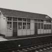
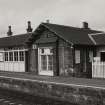
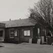
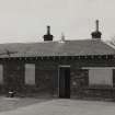
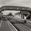
Prestonpans Station
Drain (Post Medieval), Railway Station (19th Century)
Site Name Prestonpans Station
Classification Drain (Post Medieval), Railway Station (19th Century)
Alternative Name(s) Tranent Station
Canmore ID 209974
Site Number NT37SE 147
NGR NT 39220 73763
Datum OSGB36 - NGR
Permalink http://canmore.org.uk/site/209974
- Council East Lothian
- Parish Prestonpans
- Former Region Lothian
- Former District East Lothian
- Former County East Lothian
NT37SE 147 39220 73763
Annotated as 'Tranent Station' on the 1st Edition of the OS 6-inch map ((Haddingtonshire 1854, sheet 8).
(Undated) information in NMRS.
NT 392 737 An archaeological evaluation was carried out at Prestonpans Station, East Lothian in advance of the construction of a car park. The proposed development area is believed to lie on the route taken by defeated government troops fleeing the Battle of Prestonpans in 1745. A number of field drains of the horseshoe type were uncovered, but there were no features, deposits or artefacts of archaeological significance.
Sponsor: First ScotRail
Magnus Kirby, 2007.
Archaeological Evaluation (10 May 2007 - 11 May 2007)
NT 3920 7372 An evaluation was carried out at Prestonpans Station on 10-11 May 2007 in advance of the construction of a car park. The proposed development area is believed to lie on the route taken by defeated government troops fleeing the Battle of Prestonpans in 1745. A number of field drains of the horseshoe type were uncovered, but there were no features, deposits or artefacts of archaeological significance.
Archive deposited with RCAHMS, East Lothian Council SMR.
Funder: First ScotRail.
Magnus Kirby, 2007.


