
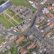
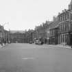
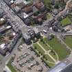
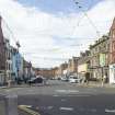
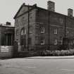
Dunbar, High Street, Lauderdale House


Barracks (19th Century), Barracks (First World War), Flats(S) (20th Century), Town House (18th Century)
Site Name Dunbar, High Street, Lauderdale House
Classification Barracks (19th Century), Barracks (First World War), Flats(S) (20th Century), Town House (18th Century)
Alternative Name(s) Victoria Street; Castle Park Barracks; Castlepark Barracks; Dunbar House
Canmore ID 207335
Site Number NT67NE 200
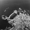
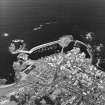
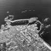
NGR NT 67844 79099
Datum OSGB36 - NGR
Permalink http://canmore.org.uk/site/207335


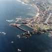
- Council East Lothian
- Parish Dunbar
- Former Region Lothian
- Former District East Lothian
- Former County East Lothian
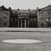
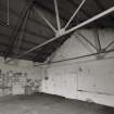
During the First World War Lauderdale House was used to accommodate army units and during the Second World War, it was the HQ of 165th Officer Training Unit, which was also responsible for the defence of the town and the adjacent areas against German invasion.
Information from HS/RCAHMS World War One Audit Project (GJB) 12 September 2013.
NMRS REFERENCE
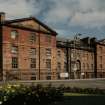
Architect: Robert Adam - 1790-92.
Dave Roberts - 1818, design for adds to earlier house & design for stables.
John Jackson - 1818, interior decoration.
EXTERNAL REFERENCE
Scottish Records Office
Estimates and correspondence.
Mr Adam recommends that William Aitkens estimate is accepted.
1790 GD 18/4965
1910 Proposed window for shop belonging to Mr Peter Stevenson.
Plans: Dunbar, Dean of Guild Drawings. Plan no. 282.
Photographic Survey (November 1959)
Photographic survey by the Scottish National Buildings Record in November 1959.
Publication Account (1981)
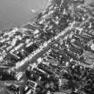
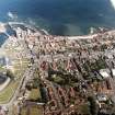
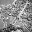
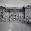
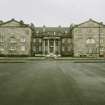
One of the most imposing mansions to survive in the medieval core is Lauderdale House, formerly called Dunbar house. The mansion was built in 1734 by a prominent citizen Provost Fall, who later sold it to the Duke of Lauderdale in 1788 (Green, 1907, 180).
Information from ‘Historic Dunbar: The Archaeological Implications of Development’ (1981).
Publication Account (2006)
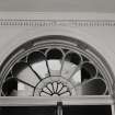
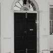
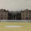
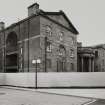
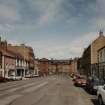
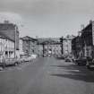
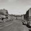
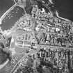
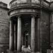
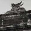
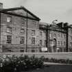
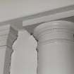
The most prestigious of these [Georgian] houses, was, Dunbar House (or Lauderdale House), standing imposingly at the north end of High Street. This had been built by James Fall, a wealthy merchant trading with the Baltic and the Mediterranean, and for some years a member of parliament. The Fall family were, however, obliged to sell the property in 1788; it was then handsomely altered and enlarged by Robert Adam for the Earl of Lauderdale, with such features as two wings added to the original block, a new entrance with semicircular portico facing north and a sphinx gracing the south side. So large and impressive was the house that one tourist mistook it for a hospital. Another visitor, in the same year, 1795, while commenting favourably on the house and the alterations effected by Lauderdale, added somewhat acidly 'from his Lordship Head being so full of Politicks he has only been once in it'.
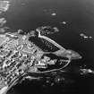
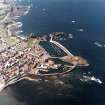
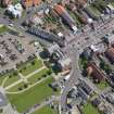
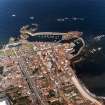
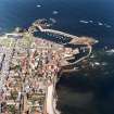
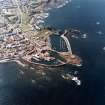
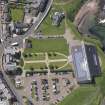
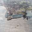
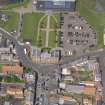
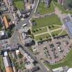
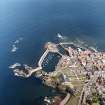
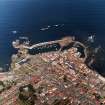
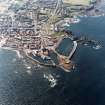
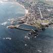
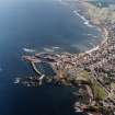
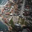
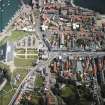
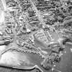
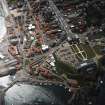
Perhaps the most imposing building in Dunbar is the category ‘A’–listed Dunbar House, situated prominently at the end of High Street. Captain James Fall, MP, commissioned the core of the house, but his son was declared bankrupt in 1788 and he was obliged to sell the land to the Earl of Lauderdale. He commissioned Robert Adam to add two wings and the northern entrance portico. The surrounding grounds of Castle Park were landscaped to complement the house (fig 19).
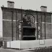
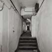
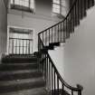
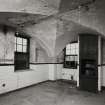
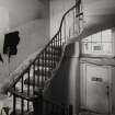
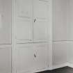
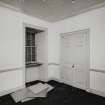
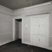
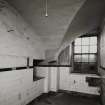
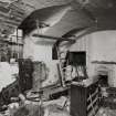
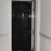
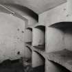
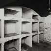
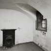
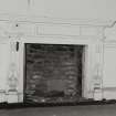
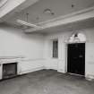
In 1855 the house was sold to the War Office and converted into barracks. This led to much of the interior being stripped out and the insertion of new windows and a staircase-well in the eastern end of the building. The military constructed new barracks and gun platforms within the park. As a result of defence cutbacks in the 1950s the barracks were sold back to the county council. Dunbar House was converted into residential flats and the new barracks were demolished.
Information from ‘The Scottish Burgh Survey, Historic Dunbar: Archaeology and Development’, (2006).
Project (March 2013 - September 2013)
A project to characterise the quantity and quality of the Scottish resource of known surviving remains of the First World War. Carried out in partnership between Historic Scotland and RCAHMS.

