
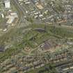
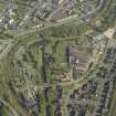
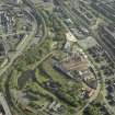
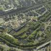
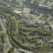
Monkland Canal, Gartsherrie Branch, Howes Basin Bridge


Bridge (Period Unknown)
Site Name Monkland Canal, Gartsherrie Branch, Howes Basin Bridge
Classification Bridge (Period Unknown)
Alternative Name(s) Monkland Canal, Gartsherrie Branch, Summerlee East Basin Bridge
Canmore ID 205406
Site Number NS76NW 66.04
NGR NS 7306 6550
Datum OSGB36 - NGR
Permalink http://canmore.org.uk/site/205406


- Council North Lanarkshire
- Parish Old Monkland (Monklands)
- Former Region Strathclyde
- Former District Monklands
- Former County Lanarkshire
NS76NW 66.04 7306 6550.
This bridge carries the canal towpath over the entrance to Howes Basin (NS76NW 66.03).
G Hutton 1993.
In photographs in the North Lanarkshire Archives, Cumbernauld (Monklands Photographic Collection, U6 1884, c.1900 and U6 1141 c.1984) this bridge is shown traversing the narrow channel from the canal to Howes Basin (NS76NW 66.03).
Information from RCAHMS (MD) 10 January 2002.

