
Monkland Canal, Gartsherrie Branch, Howes Basin


Canal Basin (19th Century)
Site Name Monkland Canal, Gartsherrie Branch, Howes Basin
Classification Canal Basin (19th Century)
Alternative Name(s) Monkland Canal, Gartsherrie Branch, Summerlee East Basin
Canmore ID 205402
Site Number NS76NW 66.03
NGR NS 7307 6550
Datum OSGB36 - NGR
Permalink http://canmore.org.uk/site/205402


- Council North Lanarkshire
- Parish Old Monkland (Monklands)
- Former Region Strathclyde
- Former District Monklands
- Former County Lanarkshire
NS76NW 66.03 7307 6550.
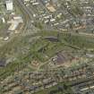
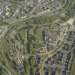
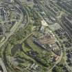
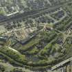
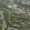
This basin was constructed as a coal transhipment basin and was originally associated with the Monkland and Kirkintilloch Railway. The Summerlee Heritage Trust have restored the basin as an exhibit. A bridge (NS76NW 66.04) carries the canal towpath over the entrance to the basin.
G Hutton 1993.
This basin, just to the E of the canal, but appearing to be separated from it, is clearly shown on the 1st edition of the OS 6-inch map (Lanarkshire 1864, sheet vii) and on the 2nd edtion of the OS 6-inch map (Lanarkshire 1899, sheet viiSE).
In the North Lanarkshire Archives, Cumbernauld (Monklands Photographic Collsection, U6 1328, c.1988 and U6 1141, c.1984) the basin is clearly shown. In the latter photograph a bridge (NS76NW 66.04) is visible over the narrow channel to the basin.
Information from RCAHMS (MD) 10 January 2002.

