
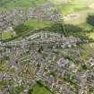
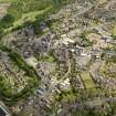
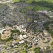
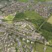
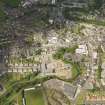
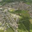
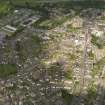
Cumnock, Glaisnock Street, General


General View (Period Unassigned)
Site Name Cumnock, Glaisnock Street, General
Classification General View (Period Unassigned)
Canmore ID 204562
Site Number NS51NE 28
NGR NS 57078 19732
NGR Description From NS 56824 20152 to NS 57213 19366
Datum OSGB36 - NGR
Permalink http://canmore.org.uk/site/204562


- Council East Ayrshire
- Parish Old Cumnock
- Former Region Strathclyde
- Former District Cumnock And Doon Valley
- Former County Ayrshire
NMRS REFERENCE:
Glaisnock Street spans two map sheets: NS51NE and NS52SE.

