Accessibility

Font Size

100% 150% 200%

Background Colour

Default Contrast
Close Reset

Aberdeen, 42 St Paul Street

Unidentified Flint(S) (Flint)(Period Unassigned)

Site Name Aberdeen, 42 St Paul Street

Classification Unidentified Flint(S) (Flint)(Period Unassigned)

Alternative Name(s) E6; St Paul's Street, Farquhar And Gill's; Boys' Hospital (Former); Anderson's Mansion; Drum's Lane

Canmore ID 20212

Site Number NJ90NW 86

NGR NJ 9412 0649

Datum OSGB36 - NGR

Permalink http://canmore.org.uk/site/20212

Ordnance Survey licence number AC0000807262. All rights reserved.
Canmore Disclaimer. © Bluesky International Limited 2025. Public Sector Viewing Terms

Toggle Aerial | View on large map

Digital Images

Unidentified features.
Unidentified features.Area B: Trial trenchArea C: layer 11Area B: brick wall?Area C: Weaving sword, layer 23, Cat.No.696Area C: layer 77Area C: layer 23Lifting weaving sword.Lifting weaving sword.Area B: Stone circle JLArea B: VD/VCArea B: layer 49, underground chambers - details and general viewsArea B: layer 49, underground chambers - details and general viewsArea B: layer 49, underground chambers - details and general viewsArea A: Wattle, layer 74/94/30/25Area B: layer 61/65Unidentified excavation feature.Unidentified excavation feature.Area C: Lifting spoonArea C: General view N & SGeneral view of site.Unidentified features.Unidentified features.Unidentified features.Area D: Unidentified features.Area D: Unidentified features.Area D: Unidentified features.Area B: JO, JA, JG/SiteArea B: StairwayUnidentified features.Unidentified features.Unidentified features.Unidentified features.Unidentified features.Area A: SAK, TAF?Area A: TAF, layer 237Area D: layer 39, 40, 25Area A: TAN, TAO, naturalArea D: WN, layer 49, 50Area C: DY, EA, layer 287Studio: site map.Area F: General viewArea F: General viewArea F: General viewArea F: General viewStudio: DrawingAreas D, F, H, A: General viewArea B: Trench B JE, layer 9Area A: Rubble & mortar, layer 3Area B: layer 4-10Bronze sword from TillydroneArea A: layer 2OAreas D, F, H, A: General viewAreas D, F, H, A: General viewArea G, D: General viewArea G, D: General viewArea G, D: General viewArea G, D: General viewArea G, D: General viewArea D: Natural, layer 56, 71Unidentified feature.Area C: Sections WUnidentified feature.Area B: KK, KLUnidentified feature.Unidentified feature.Unidentified feature.Area E: Section NArea A: Section EArea A: Section EArea A: Section EArea A: Section SUnidentified feature.Area D: WN, layer 46View of unidentifed people in flooded areaView of unidentifed people in flooded areaView of unidentifed people at coffee breakView of unidentifed people at coffee breakView of unidentifed people at coffee breakArea D: layer 39, 40, 25Area G, D: General viewArea C: Sections WArea B: Trial trenchArea B: Trial trenchArea B: Trench B, cutting JC EArea C: layer 6, 8, 9Area A: layer 2OArea C: AK EWeaving sword - preparation to liftingArea B: VBLifting weaving sword.Lifting weaving sword.Lifting weaving sword.Trench 2: pot shard, layer 16Area B: layer 61/65Area A: SEArea C: BP layer 62-143Pot rim, Scarborough ware.Beast's head spout.Unidentified excavation feature.

First 100 images shown. See the Collections panel (below) for a link to all digital images.

Administrative Areas

  • Council Aberdeen, City Of
  • Parish Aberdeen
  • Former Region Grampian
  • Former District City Of Aberdeen
  • Former County Aberdeenshire

Archaeology Notes

NJ90NW 86 9412 0649

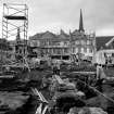
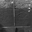
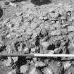
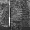
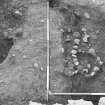
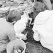
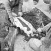
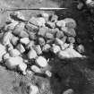
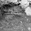
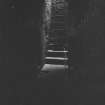
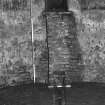
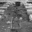
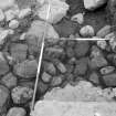
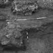
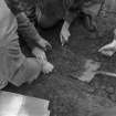
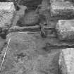
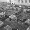
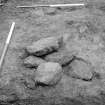
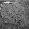
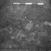
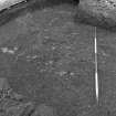
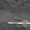
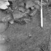
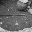
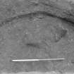
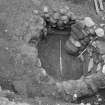
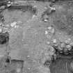
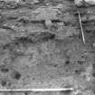
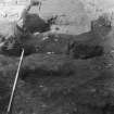
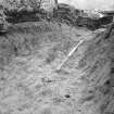
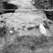
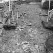
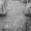
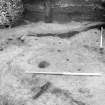
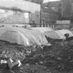
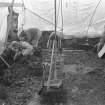
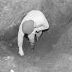
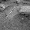
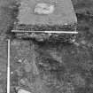
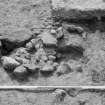
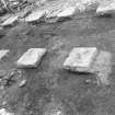
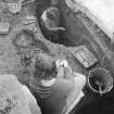
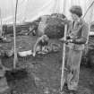
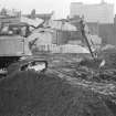
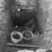
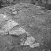
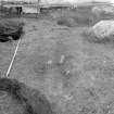
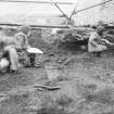
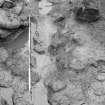
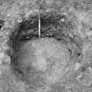
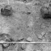
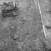
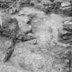
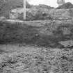
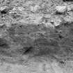
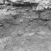
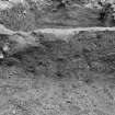
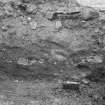
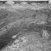
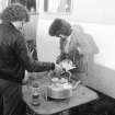
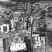
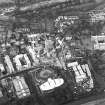
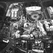
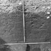
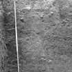
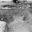
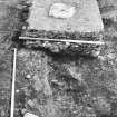
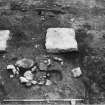
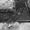
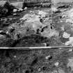
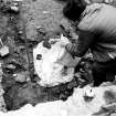
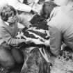
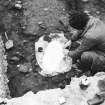
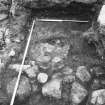
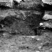
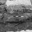
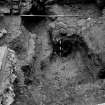
(Location cited as NJ 9412 0648 and site-name as St Paul's Street, Farquhar and Gill's). Large-scale excavation by C M Brooks (as a Job Creation Project) over the winter of 1977-8 examined an area formerly occupied by warehouses and revealed undisturbed medieval deposits which were rich in organic debris, and also traces of an early wattle structure. There were also identified: rigs of 12th century date, pits; middens, a bread oven and traces of five houses of the 13th century and a 14th century house. There is extensive documentary evidence for work- and craft-shops on the site since the 16th century.

(Newspaper, magazine and other references listed; location of finds not specified].

NMRS, MS/712/83.

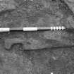
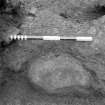
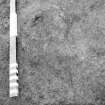
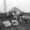
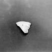
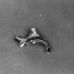
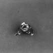
Of the 141 pieces of flint recovered from the excavation of 42 St Paul Street in the 1970's, a total of 93 appear to be of Mesolithic date, including cores, microburins, a burin spall, scrapers, a wedge and a number of flakes. The finds from the excavation are now in Aberdeen Art Gallery and Museum.

Information from RCAHMS (JRS), 28 May 1997.

Architecture Notes

NMRS REFERENCE:

Aberdeen, 42 St. Paul Street.

Built c. 1741. Demolished 1977.

Re-used as Boys' Hospital.

Later incorporated into Farquar & Gill Warehouse.

References

MyCanmore Image Contributions


Contribute an Image

MyCanmore Text Contributions