
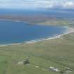
Dunnet Bay


Anti Tank Blocks (20th Century)
Site Name Dunnet Bay
Classification Anti Tank Blocks (20th Century)
Alternative Name(s) Stangergill Burn; Links Of Old Tain; Thurdistoft
Canmore ID 201695
Site Number ND26NW 47
NGR ND 2130 6910
NGR Description ND 2015 6818 and ND 2043 6817
Datum OSGB36 - NGR
Permalink http://canmore.org.uk/site/201695

- Council Highland
- Parish Dunnet
- Former Region Highland
- Former District Caithness
- Former County Caithness
ND26NW 47 2015 6818 and 2043 6817
Two short lengths of anti-tank blocks have been identified from post-war RAF vertical air photographs (CPE/Scot/UK/264, 3036-7, flown 14 August 1947). One length (ND 2015 6818), protects the mouth of the Stangergill Burn and runs for about 100m each side. The second length (ND 2043 6817) protects the mouth of an unnamed burn that runs through the dunes on the Links of Old Tain, N of the junction between the A836 and a minor road to Thurdistoft farmsteading (ND26NW 43).
Information from RCAHMS (DE), November 2001.

