
Aberdeen, Old Aberdeen, 64-72 Don Street


No Class (Event) (Period Unassigned)
Site Name Aberdeen, Old Aberdeen, 64-72 Don Street
Classification No Class (Event) (Period Unassigned)
Alternative Name(s) E26; 'old Aberdeen Settlement'
Canmore ID 20134
Site Number NJ90NW 223
NGR NJ 940 086
Datum OSGB36 - NGR
Permalink http://canmore.org.uk/site/20134


- Council Aberdeen, City Of
- Parish Aberdeen
- Former Region Grampian
- Former District City Of Aberdeen
- Former County Aberdeenshire
NJ90NW 223 940 086
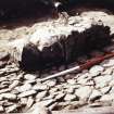
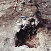
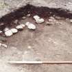
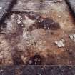
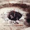
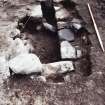
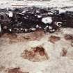
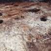
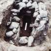
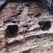
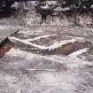
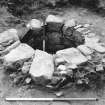
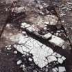
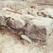
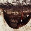
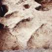
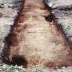
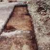
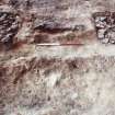
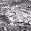
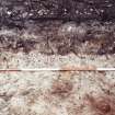
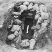
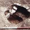
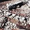
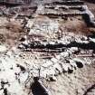
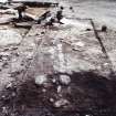
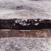
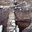
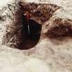
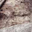
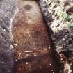
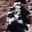
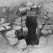
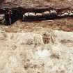
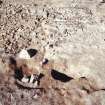
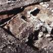
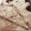
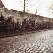
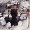
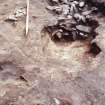
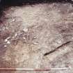
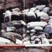
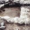
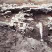
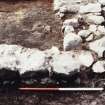
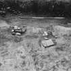
What should have been a promising site E of the main road to the N from Old Aberdeen and just outside one of the ports or gates to the close of St Machar's Cathedral (NJ90NW 9.1) proved to have been seriously disturbed by horticulture in the 19th and early 20th centuries. Only features cut into the natural sand remained. Two 18th century stone lined wells were discovered, one associated with buildings of that date along the Don Street frontage, and one towards the rear of the site. In addition, the bases of two brick-built peat-fired furnaces and a fire pit, probably 18th century in date, were found near the Don Street frontage. All traces of superstructure had disappeared. A single shallow ditch ran approximately W-E across part of the site and may have been a boundary ditch of 16th-17th century date.
J A Stones 1987.
Listed as 'Old Aberdeen settlement' at NJ 941 087.
(Newspaper references cited).
NMRS, MS/712/83.
The excavation archive from 64-72 Don Street has been catalogued. It consists of photographic material, drawings and manuscripts.
Historic Scotland Archive Project (FO) 1997.

