
Pricing Change
New pricing for orders of material from this site will come into place shortly. Charges for supply of digital images, digitisation on demand, prints and licensing will be altered.
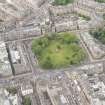
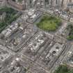
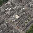
Edinburgh, Randolph Lane, General


General View (Period Unassigned)
Site Name Edinburgh, Randolph Lane, General
Classification General View (Period Unassigned)
Canmore ID 201057
Site Number NT27SW 3336
NGR NT 24546 73865
NGR Description From NT 2454 7392 to NT 2455 7382
Datum OSGB36 - NGR
Permalink http://canmore.org.uk/site/201057


- Council Edinburgh, City Of
- Parish Edinburgh (Edinburgh, City Of)
- Former Region Lothian
- Former District City Of Edinburgh
- Former County Midlothian
NT27SW 3336 centred 24546 73865
Cul-de-Sac off Charlotte Lane and Randolph Place.

