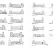
Kirkton Of Bourtie
Cup Marked Stone (Prehistoric)(Possible), Recumbent Stone Circle (Neolithic) - (Bronze Age)
Site Name Kirkton Of Bourtie
Classification Cup Marked Stone (Prehistoric)(Possible), Recumbent Stone Circle (Neolithic) - (Bronze Age)
Alternative Name(s) Kirktown Of Bourtie; Kirkton Of Bourtie Stone Circle
Canmore ID 19708
Site Number NJ82SW 2
NGR NJ 80091 24883
Datum OSGB36 - NGR
Permalink http://canmore.org.uk/site/19708
- Council Aberdeenshire
- Parish Bourtie
- Former Region Grampian
- Former District Gordon
- Former County Aberdeenshire
NJ82SW 2 80091 24883
For stone axe possibly from this monument, see NJ82NW 24.
(NJ 8008 2487) Standing Stones (NR)
OS 6" map, (1959)
At one time the circle was 'rudely paved'.
Name Book 1867.
The remains of the stone circle, originally about 60 feet in diameter, at Kirkton of Bourtie, are a recumbent stone, the east Pillar and two other stones. The recumbent stone, now broken, was originally about 16 feet long and is now 3 feet 4 inches broad and 6 feet 4 inches high. It lies on a definite mound.
The pillar is 9 feet 10 inches high by about 10 feet in girth, and the other two stones 6 feet and 7 feet 9 inches high and between 13 and 14 feet in girth.
There are also some large fragments of stone around the pillar.
(See also NJ82NW 24.)
F R Coles 1902.
The remains of this recumbent stone circle are as illustrated and described by Coles (1902). The ground in the vicinity of the recumbent stone has been used as a dump for stones from field clearancee. The remainder of the area has been ploughed and there is now no trace of paving or any other feature.
Revised at 1/2500.
Visited by OS (NKB) 5 March 1964.
(Name cited as Kirkton of Bourtie Stone Circle). This stone circle is situated in arable ground on the crest of a hill shoulder at an altitude of 157m OD. It commands an open aspect to the W, but has rising ground to the E and the Hill of Barra to the N.
NMRS, MS/712/81.
Scheduled as Kirkton of Bourtie, stone circle.
Information from Historic Scotland, scheduling document dated 22 March 2002.
The remains of this recumbent stone circle are situated in a cultivated field and comprise the recumbent, the E flanker, and two stones on the W arc. All the stones are of granite, the recumbent measuring 5.1m in length by 1.9m in height and 1.7m in thickness. The E flanker measures 2.9m in height by 1.45m in breadth and 1m in thickness. A large void beneath the E end of the recumbent has been filled in antiquity with a large boulder. The erect stones on the WSW and WNW of the circle measure 1.7m and 2.2m in height respectively.
Visited by RCAHMS (JRS, IF), 22 March 1996.
NJ 8009 2488 Recorded on 29 September 2007. In the centre of the upper surface of the recumbent a possible cup
mark.
George Currie, 2007.
Field Visit (29 April 1999)
The surviving stones of this recumbent stone circle stand in an arable field on the spur some 300m to the WSW of the Old Manse at Kirkton of Bourtie. Originally measuring about 22m in diameter, it probably comprised ten or eleven stones, of which only four now survive, namely the recumbent on the SSW (2), its E flanker (3), and two upright orthostats on the W (4 & 5). The recumbent (2), which measures 4.9m in length by 1.9m in height, is an irregularly shaped boulder with a gently domed summit and does not appear to be set horizontal, dipping markedly towards the WNW to rest on a foundation of small boulders. At the opposite end a blocking stone can be seen filling the triangular gap between it and the E flanker (3). The latter stands 2.95m high and is much taller than either of the surviving orthostats on the WNW (4) and WSW (5), but at 2.1m and 1.75m high respectively these are not graded to reduce in height from S to N. Apart from field clearance, nothing can be seen within the interior, though what was probably the base of an internal cairn was noted in the 19th century.
Visited by RCAHMS (ATW and KHJM) 29 April 1999
Field Visit (29 September 2007)
NJ 8009 2488 Recorded on 29 September 2007. In the centre of the upper surface of the recumbent a possible cup mark.
George Currie, 2007.
Field Visit (5 October 2016)
What may be the cupmark observed by George Currie is situated on the summit of the recumbent stone, 2.88m from its E end and 0.32m NNE of its front edge. It measures 0.04m in diameter and 0.006m deep.
Visited by HES, Survey and Recording (ATW, AMcC), 5 October 2016


