Pricing Change
New pricing for orders of material from this site will come into place shortly. Charges for supply of digital images, digitisation on demand, prints and licensing will be altered.
Upcoming Maintenance
Please be advised that this website will undergo scheduled maintenance on the following dates:
Thursday, 9 January: 11:00 AM - 3:00 PM
Thursday, 23 January: 11:00 AM - 3:00 PM
Thursday, 30 January: 11:00 AM - 3:00 PM
During these times, some functionality such as image purchasing may be temporarily unavailable. We apologise for any inconvenience this may cause.
Loch Shira, Bushang, Combined Operations Training Centre, Shire Camp
Military Camp (20th Century), Rig And Furrow (20th Century)
Site Name Loch Shira, Bushang, Combined Operations Training Centre, Shire Camp
Classification Military Camp (20th Century), Rig And Furrow (20th Century)
Alternative Name(s) Loch Fyne Combined Operations Training Area
Canmore ID 195767
Site Number NN11SW 24
NGR NN 1100 1035
NGR Description Centred NN 1100 1035
Datum OSGB36 - NGR
Permalink http://canmore.org.uk/site/195767
- Council Argyll And Bute
- Parish Inveraray
- Former Region Strathclyde
- Former District Argyll And Bute
- Former County Argyll
NN11SW 24 Centred NN 1100 1035
Military camp identified from air photograph.
Information from RCAHMS (KM)
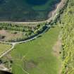
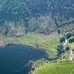
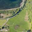
The Nissen hutted camp is visible on vertical air photographs (F 22 58/RAF 2681, 0012-0014, flown 22 January 1959), situated on level ground between Loch Shira and the Dubh Loch.
Visible on the photographs are at least 66 huts, mainly of the Nissen type. The main group lay between the main A 83(T) road and Deer Park Cottage (NN 1108 1065), with a further row situated alongside a track immediately N of the main road.
Further huts are noted in and around a quarry at NN 1130 1050, but it is not known whether these are related to the camp or to industrial workings.
The main part of the camp overlies a field of straight rig-and-furrow cultivation.
The purpose of the camp is unknown, but may have possibly been used as accommodation for logging workers or, more likely as a training camp for specialist military personnel, especially as there were Commando camps at Inverarary about 1km to the SW..
Information from RCAHMS (DE), November 2005
The camp was part of the Combined Operations training and was known as Shire Camp. One of a series of camps in the area created to train Commando's.
Information from RCAHMS (DE), July 2008


