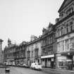
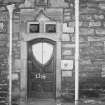
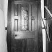
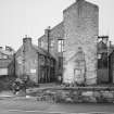
Elgin, 123-133 High Street, St Giles' Building
Shop(S) (20th Century)
Site Name Elgin, 123-133 High Street, St Giles' Building
Classification Shop(S) (20th Century)
Alternative Name(s) St Giles Centre
Canmore ID 195323
Site Number NJ26SW 360
NGR NJ 21581 62874
Datum OSGB36 - NGR
Permalink http://canmore.org.uk/site/195323
- Council Moray
- Parish Elgin
- Former Region Grampian
- Former District Moray
- Former County Morayshire
NJ26SW 360 21581 62874.
An archaeological investigation was conducted by SUAT in advance of the proposed construction of a new shopping centre on the N side of Elgin High Street in 1988. 115 and 123/133 High Street (NJ26SW 359 and NJ26SW 360 ) represented the first opportunity to examine properties close to the core of the medieval burgh. Previous monitoring work on the burgh’s street frontages suggested that any archaeological deposits there had been destroyed by extensive building programmes in the 18th and 19th centuries.
The absence of property boundaries and buildings of medieval date from both sites suggests that the layout of medieval Elgin may have been slightly different to that which has been previously suggested. The distinctive long property rigs may have a post-medieval and not a medieval origin.
Of the features recovered by these excavations, only a single pit (Trench D, 123/133 High Street(NJ26SW 360)) contained pottery which is tentatively dated to the burgh of David I, in the 12th century. Given the central locations of both sites (NJ26SW 359 and NJ26SW 360 ), this is surprising and suggests that the early burgh may have first developed between the castle on Ladyhill (NJ26SW 7) and St Giles parish church (NJ26SW 15), and then expanded eastwards towards the cathedral precinct in the 13th century. In this scenario, the site at 115 High street would have been outside the limits of the early burgh but within the area of later expansion. In contrast, the site at 123/133 High Street would have been within the limits of the early burgh, but may have been on the fringes of the earliest settlement.
Sponsors: Caltrust Sheraton Ltd, Moray District Council, Grampian Regional Council.
Hall 1998.
NJ26SW 360 21581 62874
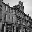
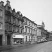
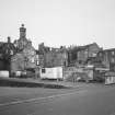
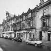
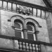
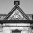
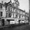
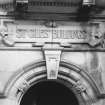
Only the facade to Nos 123-133 St Giles' Building remains. The St Giles (shopping) Centre, 1988-91, occupies the space behind. Information from RCAHMS (KD), August 2003.
Excavation (December 1987 - February 1988)
An archaeological investigation was conducted by SUAT in advance of the proposed construction of a new shopping centre on the N side of Elgin High Street in 1988. 115 and 123/133 High Street (NJ26SW 359 and 360) represented the first opportunity to examine properties close to the core of the medieval burgh. Previous monitoring work on the burgh’s street frontages suggested that any archaeological deposits there had been destroyed by extensive building programmes in the 18th and 19th centuries.
The absence of property boundaries and buildings of medieval date from both sites suggests that the layout of medieval Elgin may have been slightly different to that which has been previously suggested. The distinctive long property rigs may have a post-medieval and not a medieval origin.
Of the features recovered by these excavations, only a single pit (Trench D, 123/133 High Street(NJ26SW 360)) contained pottery which is tentatively dated to the burgh of David I, in the 12th century. Given the central locations of both sites (NJ26SW 359 and 360), this is surprising and suggests that the early burgh may have first developed between the castle on Ladyhill (NJ26SW 7) and St Giles parish church (NJ26SW 15), and then expanded eastwards towards the cathedral precinct in the 13th century. In this scenario, the site at 115 High street would have been outside the limits of the early burgh but within the area of later expansion. In contrast, the site at 123/133 High Street would have been within the limits of the early burgh, but may have been on the fringes of the earliest settlement.
Sponsors: Caltrust Sheraton Ltd, Moray District Council, Grampian Regional Council.
Hall 1998.


