
Pricing Change
New pricing for orders of material from this site will come into place shortly. Charges for supply of digital images, digitisation on demand, prints and licensing will be altered.
Greenlands


Cairnfield (Period Unassigned), Clearance Cairn (Period Unassigned), Hut Circle(S) (Prehistoric), Pottery Scatter (Period Unassigned), Rig And Furrow (Medieval) - (Post Medieval), Ring Cairn (Bronze Age)
Site Name Greenlands
Classification Cairnfield (Period Unassigned), Clearance Cairn (Period Unassigned), Hut Circle(S) (Prehistoric), Pottery Scatter (Period Unassigned), Rig And Furrow (Medieval) - (Post Medieval), Ring Cairn (Bronze Age)
Alternative Name(s) Skene's Wood; Balbithan Wood
Canmore ID 19502
Site Number NJ81NW 4
NGR NJ 8123 1778
NGR Description Centred NJ 8123 1778
Datum OSGB36 - NGR
Permalink http://canmore.org.uk/site/19502


- Council Aberdeenshire
- Parish Fintray
- Former Region Grampian
- Former District Gordon
- Former County Aberdeenshire
NJ81NW 4 centred 8123 1778
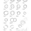
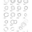
There is a late Bronze Age open village consisting of at least twenty hut-circles, and many more cairns, within the area of Skene's Wood (now heathery moorland). Eight of the hut-circles were examined and were between 25 and 35 feet in diameter, within banks of earth and stone 10 to 12 feet wide and 2 to 3 feet high. The entrances all faced approximately south and none showed any internal divisions or structures.
The cairns that were examined were of stones partly covered with soil and vegetation, and varied from 12 to 19 feet in diameter and from 18 inches to 2 feet 9 inches in height. One cairn measured 12 feet by 18 feet by 2 feet 6 inches high.
J G Callander 1925; W D Simpson 1943.
Area centred on NJ 8123 1778. In Skene's Wood, now replanted with conifers, the remains of 9 hut circles were found. They vary in diameter from 6.0m to 12.5m and in height from 0.2 to 0.8m while their turf covered banks vary in width from 1.5m to 4.0m. The entrances where apparent, are either from the south or the south east.
The cairns mentioned by Simpson are mostly heather covered and are probably clearance heaps.
Visible on RAF APs 540/1419 F 22: 0061-2.
Surveyed at 1:2500.
Visited by OS (EGC) 3 November 1961.
(Location cited as NJ 812 177 and name as Skene's Wood).
NMRS, MS/712/77.
A group of twelve hut-circles, together with numerous small cairns and an area of rig-and-furrow, is visible in the NW corner of Balbithan Wood, a Forestry Commission conifer plantation, which occupies an elevated area of poor ground about 1.5km N of the River Don. The ground was tree-covered in 1866, when it was known as Skene's Wood and surveyed for the 1st edition of the OS 6-inch map (Aberdeenshire 1870, sheet LV). The OS did not record any antiquities within the wood either then or when the map was revised in 1899 (1901, sheet LV.SW), but by the early 1920s most of the trees had been removed, and the presence of the hut-circles and small cairns was reported by a Mr AW Brown of Bankhead farm to JG Callander. The area remained open moorland until the 1950s when it was acquired by the Forestry Commission and put back under trees. RAF vertical aerial photographs (540/1419 F 22: 0061-2), taken in September 1954, record the site shortly after it was forestry-ploughed, and in 1961 the Archaeology Division of the Ordnance Survey mapped nine hut-circles for the 1965 edition of the 1:2500 map (NJ 81/17). Another three hut-circles were located in the course of the RCAHMS survey.
The hut-circles measure from 7m to 10m in diameter within walls reduced to grass- and tree-grown banks up to 4m in thickness and 0.8m in height. In the case of the three hut-circles found most recently, however, the banks are much slighter and are barely discernible in long grass. Where an entrance is visible, it is on the S or SE arc.
The small cairns, which measure up to 4m in diameter, are scattered across an extensive area. On the SE and SW they are found down to the margins of an area of boggy ground, but on the NE and NW they probably once extended into an area now occupied by rig-and-furrow. The rigs, which are best seen on the RAF vertical aerial photographs but are also clearly visible under short grass towards the N, measure up to 10m in breadth and are aligned roughly N and S.
Visited by RCAHMS (JRS, IF), August 1996.
NJ 812 178. This second phase of the Kintore Landscape Project followed on from work in 2004 (DES 2004, 15, 16; see also this volume) and examined two hut circles and associated clearance cairns at Balbithan Wood in March 2005. The hut circles survived up to two courses high, with patchily surviving occupation surfaces. Roundhouse 1 had a ring-ditch, together with numerous chipped and coarse stone tools and pot sherds. Fragments of charcoal were also retrieved. Roundhouse 2 provided one solitary find: a possible stone pot lid. The cairns were simply clearance cairns and contained
no artefacts or structures.
Archive to be deposited in NMRS.
Sponsor: HS.
M Cook and R Engl 2005.
(Location cited as NJ 812 177). Scheduled as 'Greenlands, hut circles and cairns 380m S of...'
Information from Historic Scotland, scheduling document dated 4 March 2008 [2009].
Field Visit (2009)
NJ 8100 1810 – NJ 8105 1806
This boundary bank is associated with an extensive area of rigs. However, its differing orientation suggests that it may be a residual feature from an earlier period. The rigs cover much of the area between an access track and a road to the NE. They extend beyond the track to the E and also lie to the W of the improvement period farmstead now lying abandoned in the wood. Most of the rigs have a wavelength of c10m, though
some narrower ones of c6m are interspersed. The clearance cairns seen among the rigs might belong to those fields or to the cairns that probably relate to the collection of hut circles
to the S of the rigged area (NJ81NW 4).
NJ 8121 1795
A very short stretch of bank which appears to be cut by rigs.
NJ 8121 1773 – NJ 8121 1769
A denuded boundary bank which appears to share a similar alignment to the rigs (see above). However, this feature appears slightly curvilinear and seems to be attached to one of the hut circles at its northern end.
C Shepherd 2009
Project (2009)
This project is part of the Forestry Commission's management strategy to recognise and safeguard sites in advance of timber operations that may be potentially damaging to the archaeological resource.
This historic landscape survey was undertaken at Balbithan.
C Shepherd 2009
Archaeological Evaluation (August 2011)
In August 2011 a series of test pits were dug around each hut circle and keyhole excavations were carried out on two of the hut circles. In situ charcoal was recovered from each roundhouse as well as one external feature. The artefacts from the roundhouses included worked flint and quartz as well as a Mesolithic core. Charcoal samples have been submitted for four radiocarbon dates.
Archive: RCAHMS (intended)
Funder: Forestry Commission Scotland, Oxford Archaeology North, Murray Cook, Martin Cook and Jamie Humble
Oxford Archaeology North 2011
Archaeological Evaluation (August 2013)
NJ 8123 1778 This project aims to undertake five years of keyhole excavations in and around the series of hut circles and clearance cairns in Balbithan, Wood. This work will be undertaken with students and local volunteers.
In August 2013 the project examined Hut Circle 18 and nearby Cairn 3. The hut circle measured 6.2m in diameter with a stone rich bank up to 0.6m high and 1.2m thick. The bank contains numerous sherds of Carinated and Impressed Ware. It seems unlikely that this material is redeposited and is probable that the structure is a Neolithic or Early Bronze Age ring cairn rather than a Middle Bronze Age hut circle.
Cairn 3 measured 6.6m in diameter and up to 0.75m high, although it had been flattened by a forest plough. The cairn appears to consist of a small clearance cairn around a glacial erratic, which was subsequently enlarged with the addition a kerb, and was then abutted by linear clearance. Finally, there were two small collections of stones c1m in diameter. The first was associated a cluster of 9 cores all face down and the second was associated with two pieces a leaf-shaped arrowhead, possibly broken in antiquity.
Archive: RCAHMS (intended)
Funder: Forestry Commission Scotland and Murray Cook
Murray Cook, Jamie Humble, Hana Kdoleska, Anthony Dickson, Ann MacSween - Rampart Scotland, 2013
(Source: DES)
Archaeological Evaluation (August 2014)
NJ 8123 1778 This project aims to undertake five years of keyhole excavations in and around the series of hut circles and clearance cairns in Balbithan Wood. This work will be undertaken with students and local volunteers.
In August 2014 the project examined two putative hut circles. The first was found to be a natural feature, but the second was confirmed as a hut circle, though heavily impacted by forest ploughing. In addition a c5m diameter clearance cairn was examined, this was revealed to be a linear cairn, c9m long, oriented N–S on a bedrock knoll. The body of the cairn was full of hand thrown pottery. The feature appears to be a possible long cairn.
Archive: RCAHMS (intended)
Funder: Forestry Commission Scotland and Murray Cook
Murray Cook, Jamie Humble, Fiona Watson and Anthony Dickson – Rampart Scotland
(Source: DES)
Archaeological Evaluation (August 2015)
NJ 8123 1778 This project aims to undertake five years of keyhole excavation in and around the series of hut circles and clearance cairns in Balbithan Wood. The work will be undertaken with students and local volunteers. In August 2015 we returned to the cairn feature sampled in 2014 and sampled a 40m diameter enclosure. The cairn was built on a bedrock knoll and while it had no formal structure its fill contained numerous pottery sherds and lithics.
The 40m diameter enclosure was revealed to have a substantial stone bank, with extensive stone revetment. The enclosure was subsequently levelled and had a longhouse built on it. Pottery and a hammer stone were recovered from its interior.
Archive: National Record of the Historic Environment (NRHE) intended
Funder: Aberdeenshire Council and Murray Cook
Murray Cook and Hana Kdoleska – Rampart Scotland
(Source: DES, Volume 16)

