
Pricing Change
New pricing for orders of material from this site will come into place shortly. Charges for supply of digital images, digitisation on demand, prints and licensing will be altered.
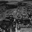
Elgin, South Street, Free Church


Church (19th Century) (1862)
Site Name Elgin, South Street, Free Church
Classification Church (19th Century) (1862)
Alternative Name(s) Former U.p. Church; High Free Church
Canmore ID 194644
Site Number NJ26SW 311
NGR NJ 21481 62671
Datum OSGB36 - NGR
Permalink http://canmore.org.uk/site/194644


- Council Moray
- Parish Elgin
- Former Region Grampian
- Former District Moray
- Former County Morayshire
Note (11 September 2024)
A church is depicted on the 1st edition of the OS 25-inch map (1871) - Elginshire VII.16 (Elgin, St Andrews Lhanbryd and Spynie).
Information from HES (D Watson) 11 September 2024

