
Stracathro


Pit(S) (Period Unknown), Ring Ditch (Prehistoric), Unenclosed Settlement (Prehistoric)
Site Name Stracathro
Classification Pit(S) (Period Unknown), Ring Ditch (Prehistoric), Unenclosed Settlement (Prehistoric)
Canmore ID 193875
Site Number NO66NW 101
NGR NO 61500 65663
Datum OSGB36 - NGR
Permalink http://canmore.org.uk/site/193875


- Council Angus
- Parish Stracathro
- Former Region Tayside
- Former District Angus
- Former County Angus
NO66NW 101 NO 61500 65663
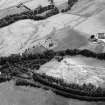
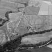
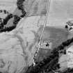
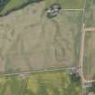
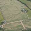
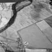
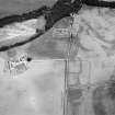
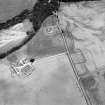
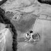
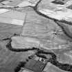
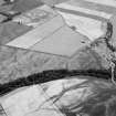
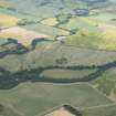
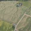
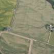
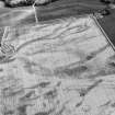
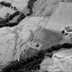
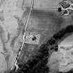
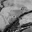
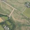
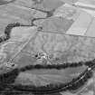
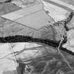
A cluster of large pits has been recorded as cropmarks on oblique aerial photography (RCAHMSAP 1981, 1982, 2000, 2003) lying on level ground within the E corner of Stracathro Roman temporary camp (NO66NW 13).
Information from RCAHMS (KMM) 23 August 2004
Watching Brief (19 February 2009 - 22 February 2009)
NO 6150 6569 A watching brief was maintained at two points within the area of Stracathro Roman temporary camp and fort on 19–22 February 2009. The laying of a c7m long low voltage underground electricity cable, c60m SW of Smiddy farmhouse, and the replacement of two electricity poles, c120m S of Stracathro church, were monitored. No archaeological features or finds were recorded.
Archive: Aberdeenshire SMR, Historic Scotland and RCAHMS
Funder: SSE Power Distribution
JC Murray – Murray Archaeological Services Ltd

